
Archivo: Huehuetenango department location map

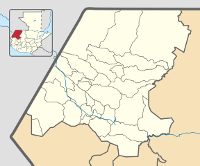
Description: Location map of the Huehetenango department, Guatemala. Equirectangular projection, geographic limits of the map: N: 16° 7'54.38"N S: 15° 4'59.95"N W: 92°16'19.93"O E: 90°58'53.95"O
Title: Huehuetenango department location map
Credit: Own work based on: Guatemala location map.svg by Spischot. Rivers and lakes from OpenStreetMap by © OpenStreetMap contributors. National, departmental and municipal boundaries from the Infraestructura de Datos Espaciales de Guatemala (IDEG) website, a Guatemalan national geographic information system, whose data is on the public domain according to the Legislative Decree 42-2001 of the Congress of Guatemala.
Author: Derivative work by Edgouno
Usage Terms: Creative Commons Attribution-Share Alike 3.0
License: CC BY-SA 3.0
License Link: https://creativecommons.org/licenses/by-sa/3.0
Attribution Required?: Yes
Usos del archivo
Las siguientes páginas enlazan a este archivo:
- Aguacatán
- Chiantla
- Colotenango
- Concepción Huista
- Cuilco
- Huehuetenango (municipio)
- Jacaltenango
- La Democracia (Huehuetenango)
- La Libertad (Huehuetenango)
- Malacatancito
- Nentón
- Nuevo León (Guatemala)
- Petatán
- San Antonio Huista
- San Gaspar Ixchil
- San Ildefonso Ixtahuacán
- San Juan Atitán
- San Juan Ixcoy
- San Mateo Ixtatán
- San Miguel Acatán
- San Pedro Nécta
- San Pedro Soloma
- San Rafael La Independencia
- San Rafael Pétzal
- San Sebastián Coatán
- San Sebastián Huehuetenango
- Santa Ana Huista
- Santa Bárbara (Guatemala)
- Santa Cruz Barillas
- Santa Eulalia (Guatemala)
- Santiago Chimaltenango
- Tectitán
- Todos Santos Cuchumatán
- Unión Cantinil
