
Archivo: Sololá department location map

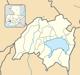
Description: Location map of the Sololá department, Guatemala. Equirectangular projection, geographic limits of the map: N: 14°59'33.87"N S: 14°29'45.00"N W: 91°35'11.79"O E: 91° 2'25.81"O
Title: Sololá department location map
Credit: Own work based on: Guatemala location map.svg by Spischot. Rivers and lakes from OpenStreetMap by © OpenStreetMap contributors. National, departmental and municipal boundaries from the Infraestructura de Datos Espaciales de Guatemala (IDEG) website, a Guatemalan national geographic information system, whose data is on the public domain according to the Legislative Decree 42-2001 of the Congress of Guatemala.
Author: Derivative work by Edgouno
Usage Terms: Creative Commons Attribution-Share Alike 3.0
License: CC BY-SA 3.0
License Link: https://creativecommons.org/licenses/by-sa/3.0
Attribution Required?: Yes
Usos del archivo
Las siguientes páginas enlazan a este archivo:
- Concepción (Sololá)
- Nahualá
- Panajachel
- San Andrés Semetabaj
- San Antonio Palopó
- San José Chacayá
- San Juan La Laguna
- San Lucas Tolimán
- San Marcos La Laguna
- San Pablo La Laguna
- San Pedro La Laguna
- Santa Catarina Ixtahuacán
- Santa Catarina Palopó
- Santa Clara La Laguna
- Santa Cruz La Laguna
- Santa Lucía Utatlán
- Santa María Visitación
- Santiago Atitlán
- Sololá (ciudad)
