
Archivo: Africa location map

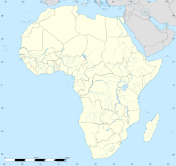
Description: Blank administrative map of political Africa as in 2011-07, for geo-location purposes. On English Wikipedia, in "Template:Location_map_Africa" to set marker along curved latitude/longitude lines.
Title: Africa location map
Credit: Based upon File:Africa_map_blank.svg created by myself Sources of data: VMap-0 Sudan/South Sudan 2011-07 border: Map Library (data of 2011-07-09) NGDC World Data Bank II
Author: Eric Gaba (Sting - fr:Sting)
Permission: Attribution and Share-Alike required Any use of this map can be made as long as you credit me (Eric Gaba – Wikimedia Commons user: Sting) as the author and distribute the copies and derivative works under the same license(s) that the one(s) stated below. A message with a reply address would also be greatly appreciated.
Usage Terms: Creative Commons Attribution-Share Alike 3.0
License: CC BY-SA 3.0
License Link: https://creativecommons.org/licenses/by-sa/3.0
Attribution Required?: Yes
Usos del archivo
Las siguientes páginas enlazan a este archivo:
- Abiyán
- Acra
- Adís Abeba
- Bamako
- Blantire
- Conakri
- Cotonú
- Dar es-Salam
- Dodoma
- Duala
- El Cairo
- Freetown
- Guitega
- Harare
- Jartum
- Kalahari
- Kampala
- Kigali
- Kinsasa
- Lagos
- Libreville
- Lilongüe
- Lusaka
- Mogadiscio
- Mombasa
- Monrovia
- Niamey
- Porto Novo
- Susa (Túnez)
- Trípoli
- Túnez (ciudad)
- Uagadugú
- Windhoek
- Yamena
- Yamusukro
- Yaundé
- Yuba (Sudán del Sur)
- Zanzíbar
