
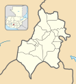
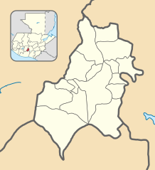
Archivo: Sacatepéquez department location map

Description: Location map of the Sacatepéquez department, Guatemala. Equirectangular projection, geographic limits of the map: N: 14°45'31.41"N S: 14°20'59.64"N W: 90°57'49.69"O E: 90°34'52.13"O
Title: Sacatepéquez department location map
Credit: Own work based on: Guatemala location map.svg by Spischot. Rivers and lakes from OpenStreetMap by © OpenStreetMap contributors. National, departmental and municipal boundaries from the Infraestructura de Datos Espaciales de Guatemala (IDEG) website, a Guatemalan national geographic information system, whose data is on the public domain according to the Legislative Decree 42-2001 of the Congress of Guatemala.
Author: derivative work by Edgouno
Usage Terms: Creative Commons Attribution-Share Alike 3.0
License: CC BY-SA 3.0
License Link: https://creativecommons.org/licenses/by-sa/3.0
Attribution Required?: Yes
Usos del archivo
Las siguientes páginas enlazan a este archivo:
- Alotenango
- Antigua Guatemala
- Ciudad Vieja (Guatemala)
- Jocotenango
- Magdalena Milpas Altas
- Pastores (Sacatepéquez)
- San Antonio Aguas Calientes
- San Bartolomé Milpas Altas
- San Lucas Sacatepéquez
- San Miguel Dueñas
- Santa Catarina Barahona
- Santa Lucía Milpas Altas
- Santa María de Jesús
- Santiago Sacatepéquez
- Santo Domingo Xenacoj
- Sumpango
