Le Relecq-Kerhuon para niños
Datos para niños Le Relecq-KerhuonAr Releg-Kerhuon |
||
|---|---|---|
| Entidad subnacional | ||
 |
||
 Escudo
|
||
|
Localización de Le Relecq-Kerhuon
Ar Releg-Kerhuon en Francia |
||
| Coordenadas | 48°24′31″N 4°23′49″O / 48.408611111111, -4.3969444444444 | |
| Capital | Le Relecq-Kerhuon | |
| Entidad | Comuna francesa | |
| • País | ||
| • Región | Bretaña | |
| • Departamento | Finisterre | |
| • Distrito | distrito de Brest | |
| • Cantón | cantón de Guipavas | |
| • Mancomunidad | Communauté urbaine de Brest Métropole Océane | |
| Alcalde | Yohann Nédélec (2008-2014) |
|
| Superficie | ||
| • Total | 6.43 km² | |
| Altitud | ||
| • Media | 0, 96 y 37 m s. n. m. | |
| Población (2007) | ||
| • Total | 10 746 hab. | |
| • Densidad | 1840,9 hab./km² | |
| Gentilicio | Relecquois, Relecquoise (en francés) Kerhorre (en bretón) |
|
| Huso horario | CET (UTC +1) | |
| • en verano | CEST (UTC +2) | |
| Código postal | 29480 | |
| Código INSEE | 29235 | |
| Sitio web oficial | ||
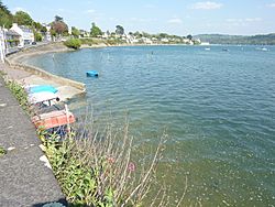
Le Relecq-Kerhuon es una pequeña y encantadora comuna francesa ubicada en la hermosa región de Bretaña, en Francia. Su nombre en bretón es Ar Releg-Kerhuon. Esta localidad forma parte del departamento de Finisterre, dentro del distrito de Brest y el cantón de Guipavas.
¿Cuántas personas viven en Le Relecq-Kerhuon?
La población a lo largo del tiempo
La demografía es el estudio de cómo cambia la población de un lugar con el tiempo. En Le Relecq-Kerhuon, la cantidad de habitantes ha crecido bastante.
- En 1962, vivían 6.526 personas.
- Para 1968, la población subió a 7.001.
- En 1975, ya eran 8.499 habitantes.
- En 1982, la cifra llegó a 9.286.
- Para 1990, se registraron 10.569 personas.
- En 1999, la población era de 10.866.
- Según los datos de 2007, Le Relecq-Kerhuon tenía 10.746 habitantes.
Estos números nos muestran cómo la comuna ha ido creciendo y desarrollándose a lo largo de los años.
Véase también
 En inglés: Le Relecq-Kerhuon Facts for Kids

Todo el contenido de los artículos de la Enciclopedia Kiddle (incluidas las imágenes) se puede utilizar libremente para fines personales y educativos bajo la licencia Atribución-CompartirIgual a menos que se indique lo contrario. Citar este artículo:
Le Relecq-Kerhuon para Niños. Enciclopedia Kiddle.

