
Archivo: USA Florida relief location map

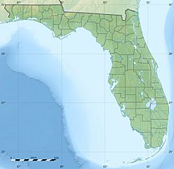
Description: Blank physical map of the State of Florida, USA, for geo-location purpose, with counties boundaries.
Title: USA Florida relief location map
Credit: Own work Sources of data: NGDC Coastal Relief Model (public domain); Public domain data provided by the National Atlas of the United States of America.
Author: Eric Gaba (Sting - fr:Sting)
Permission: Attribution and Share-Alike required Any use of this map can be made as long as you credit me (Eric Gaba – Wikimedia Commons user: Sting) as the author and distribute the copies and derivative works under the same license(s) that the one(s) stated below. A message with a reply address would also be greatly appreciated.
Usage Terms: Creative Commons Attribution-Share Alike 3.0
License: CC BY-SA 3.0
License Link: http://creativecommons.org/licenses/by-sa/3.0
Attribution Required?: Yes
Usos del archivo
Las siguientes páginas enlazan a este archivo:
- Bahía Apalachicola
- Bahía de Apalache
- Bahía de Pensacola
- Bahía de Tampa
- Cabo Cañaveral
- Cabo Romano
- Cabo Sable
- Devil's Den
- Diez Mil Islas
- Discovery Island (Florida)
- Isla Santa Rosa (Florida)
- Isla Star (Miami Beach)
- Lago Bay (Florida)
- Lago Okeechobee
- Mil Islas (Cocoa Beach)
- Pantano de Santa Fe
- Parque estatal Cavernas de Florida
- Parque nacional Biscayne
- Parque nacional Tortugas Secas
- Parque nacional de los Everglades
- Península de Fairpoint
- Península de Pinellas
