
Archivo: Ireland relief location map

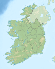
Description: Relief location map of Ireland Equirectangular map projection on WGS 84 datum, with N/S stretched 170% Geographic limits: West: 11.0° W East: 5.0° W North: 55.6° N South: 51.2° N
Title: Ireland relief location map
Credit: Shuttle Radar Topography Mission Relief data National Geospatial-Intelligence Agency Coastline data File:Ireland location map.svg: NordNordWest Borders
Author: Nilfanion
Permission: This file is licensed under the Creative Commons Attribution-Share Alike 3.0 Unported license. You are free: to share – to copy, distribute and transmit the work to remix – to adapt the work Under the following conditions: attribution – You must give appropriate credit, provide a link to the license, and indicate if changes were made. You may do so in any reasonable manner, but not in any way that suggests the licensor endorses you or your use. share alike – If you remix, transform, or build upon the material, you must distribute your contributions under the same or compatible license as the original. https://creativecommons.org/licenses/by-sa/3.0 CC BY-SA 3.0 Creative Commons Attribution-Share Alike 3.0 truetrue
Usage Terms: Creative Commons Attribution-Share Alike 3.0
License: CC BY-SA 3.0
License Link: https://creativecommons.org/licenses/by-sa/3.0
Attribution Required?: Yes
Usos del archivo
Las siguientes páginas enlazan a este archivo:
- Acantilados de Moher
- An Cnoc Buí
- Ard Éireann
- Aughinish
- Bahía de Dingle
- Binn Bhán
- Binn Chaorach
- Binn Chuilceach
- Brandon Hill
- Cabo de Old Head of Kinsale
- Carn Clainne Aodha
- Carrantuohill
- Castillo de Aughnanure
- Cathair na Féinne
- Cipiúr
- Cnoc Maol Réidh
- Cnoc Mhaoldomhnaigh
- Cnoc Mór na nGaibhlte
- Connemara
- Cueva de Dunmore
- Cuevas de Kesh
- Devils Bit
- Dún Aengus
- El Burren
- Errigal
- Glenveagh
- Grianán de Ailech
- Inchydoney
- Inis Cathaigh
- Inis Mac Neasáin
- Inishfree
- Inishmurray
- Inishtrahull
- Isla Achill
- Isla Bull
- Isla Dalkey
- Isla Omey
- Isla Tory
- Isla de Lambay
- Isla de Valentia
- Lago Corrib
- Lago Derg (Shannon)
- Lago Eske
- Lago Glencar
- Log na Coille
- Lough Key
- Macgillicuddy's Reeks
- Maumturks
- Monasterio de Dysert O'Dea
- Montaña Benbulbin
- Montañas Blue Stack
- Montañas Dartry
- Montañas Knockmealdown
- Montañas Shehy
- Montañas Silvermines
- Montañas Slieve Bloom
- Montañas Slieve Mish
- Montañas de Blackstairs
- Montañas de Ox
- Monte Brandon
- Monte Leinster
- Montes Comeragh
- Montes Derryveagh
- Parque nacional de Connemara
- Parque nacional de Wild Nephin
- Punta Carnsore
- Roca Tuskar
- Río Eske
- Río Lee
- Sailtean na Sagart
- Sliabh Feá
- Sliabh na Caillí
- Sruth in Aghaidh an Aird
- Trosc Mór
- Twelve Bens
- Árbol hambriento
