
Archivo: Essex UK location map

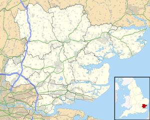
Description: Map of Essex, UK with the following information shown: Administrative borders Coastline, lakes and rivers Roads and railways Urban areas Equirectangular map projection on WGS 84 datum, with N/S stretched 160% Geographic limits: West: 0.06W East: 1.32E North: 52.11N South: 51.42N
Title: Essex UK location map
Credit: Ordnance Survey OpenData. Administrative borders and coastline data from Boundary-Line product. All other geographic data from Meridian 2 product. Inset derived from England location map.svg by Spischot.
Author: Nilfanion, created using Ordnance Survey data
Permission: This file is licensed under the Creative Commons Attribution-Share Alike 3.0 Unported license. Attribution: Contains Ordnance Survey data © Crown copyright and database right You are free: to share – to copy, distribute and transmit the work to remix – to adapt the work Under the following conditions: attribution – You must attribute the work in the manner specified by the author or licensor (but not in any way that suggests that they endorse you or your use of the work). share alike – If you alter, transform, or build upon this work, you may distribute the resulting work only under the same or similar license to this one. http://creativecommons.org/licenses/by-sa/3.0 CC BY-SA 3.0 Creative Commons Attribution-Share Alike 3.0 truetrue
Usage Terms: Creative Commons Attribution-Share Alike 3.0
License: CC BY-SA 3.0
License Link: http://creativecommons.org/licenses/by-sa/3.0
Attribution Required?: Yes
Usos del archivo
Hay más de 100 páginas que enlazan con este archivo. La lista siguiente sólo muestra las primeras 100 páginas que enlazan con este archivo. También puedes consultar la lista completa.
- Alresford
- Althorne
- Ardleigh
- Ashdon
- Barnston
- Basildon
- Birchanger
- Black Notley
- Boreham
- Bradwell (Essex)
- Braintree
- Brentwood (Essex)
- Bures (Inglaterra)
- Burnham-on-Crouch
- Canewdon
- Canvey Island
- Castle Hedingham
- Catedral de Santa María y Santa Helena (Brentwood)
- Chelmsford
- Chickney
- Chigwell
- Chipping Ongar
- Clacton-on-Sea
- Coggeshall
- Colchester
- Cold Norton
- Colne Engaine
- Danbury (Essex)
- Dedham (Essex)
- Doddinghurst
- Earls Colne
- East Hanningfield
- Elsenham
- Epping (Essex)
- Felsted
- Finchingfield
- Frinton-on-Sea
- Goldhanger
- Gosfield
- Great Bentley
- Great Chesterford
- Great Dunmow
- Great Horkesley
- Great Sampford
- Great Tey
- Great Waltham
- Great Yeldham
- Halstead
- Harlow
- Harwich
- Hatfield Broad Oak
- Hatfield Heath
- Hatfield Peverel
- Henham
- High Easter
- Hullbridge
- Kelvedon
- Kelvedon Hatch
- Latchingdon
- Leaden Roding
- Little Dunmow
- Little Hallingbury
- Little Totham
- Little Waltham
- Littlebury
- Maldon
- Manningtree
- Manuden
- Margaretting
- Marks Tey
- Newport (Essex)
- North Fambridge
- North Weald Bassett
- Panfield
- Parkeston
- Peldon
- Purfleet
- Purleigh
- Rayleigh (Essex)
- Rettendon
- Ridgewell
- Rochford
- Saffron Walden
- Sible Hedingham
- Silver End
- South Woodham Ferrers
- Southend-on-Sea
- Southminster
- St Osyth
- Stanford-le-Hope
- Stansted Mountfitchet
- Stapleford Abbotts
- Stebbing (Essex)
- Steeple
- Steeple Bumpstead
- Stock (Essex)
- Takeley
- Thaxted
- Theydon Bois
- Thorpe-le-Soken
