
Archivo: Caucasus topo map-blank

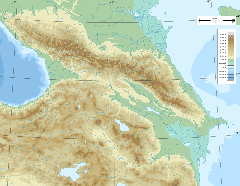
Description: Topographic map in French of Caucasus
Title: Caucasus topo map-blank
Credit: Own work ; Topographic data from the NASA Shuttle Radar Topography Mission (SRTM3 v.2) (public domain) edited with 3DEM, reprojected in UTM with GDAL (GDAL), and vectorized with Inkscape ; UTM projection ; WGS84 datum ; shaded relief (composite image of N-W, W and N lightning positions) ; Reference used for the additional data : * Rivers, bathymetry : Demis add-on for World Wind (see the approval e-mail and the Demis forum) ; * coast : World data bank II ; Approximate scale of topographic data : 1:1,463,000 ; Note : The shaded relief is a raster image embedded in the SVG file.
Author: Bourrichon - fr:Bourrichon)
Permission: GFDL / Attribution and Share-Alike required
Usage Terms: Creative Commons Attribution-Share Alike 4.0
License: CC BY-SA 4.0
License Link: https://creativecommons.org/licenses/by-sa/4.0
Attribution Required?: Yes
Usos del archivo
Las siguientes páginas enlazan a este archivo:
