
Archivo: Wales relief location map

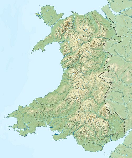
Description: Relief map of Wales, UK. Equirectangular map projection on WGS 84 datum, with N/S stretched 170% West: 5.5W East: 2.5W North: 53.5N South: 51.3N
Title: Wales relief location map
Credit: Ordnance Survey OpenData. Relief data from Land-Form Panorama product. Administrative borders and coastline data from Boundary-Line product. All other geographic data from Meridian 2 product.
Author: Nilfanion, created using Ordnance Survey data
Permission: This file is licensed under the Creative Commons Attribution-Share Alike 3.0 Unported license. Attribution: Contains Ordnance Survey data © Crown copyright and database right You are free: to share – to copy, distribute and transmit the work to remix – to adapt the work Under the following conditions: attribution – You must give appropriate credit, provide a link to the license, and indicate if changes were made. You may do so in any reasonable manner, but not in any way that suggests the licensor endorses you or your use. share alike – If you remix, transform, or build upon the material, you must distribute your contributions under the same or compatible license as the original. https://creativecommons.org/licenses/by-sa/3.0 CC BY-SA 3.0 Creative Commons Attribution-Share Alike 3.0 truetrue
Usage Terms: Creative Commons Attribution-Share Alike 3.0
License: CC BY-SA 3.0
License Link: https://creativecommons.org/licenses/by-sa/3.0
Attribution Required?: Yes
Usos del archivo
Las siguientes páginas enlazan a este archivo:
- Aberaeron
- Anglesey
- Bahía Caswell
- Brecon Beacons
- Bryn Alyn
- Castillo de Conwy
- Cordillera Berwyn
- Cámara funeraria de St Lythans
- Dinas Emrys
- Faro de Trwyn Du
- Isla Holy (Anglesey)
- Montes Cámbricos
- Parque nacional de la Costa de Pembrokeshire
- Pentre Ifan
- Península de Gower
- Península de Lleyn
- Puente colgante de Menai
- Pumlumon
- Río Conwy
- Snowdon
- Snowdonia
- Tejo de Llangernyw
