
Archivo: United States land claims and cessions 1782-1802
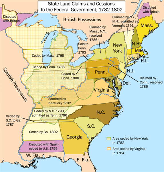
Description: This is a map showing state land claims and cessions from 1782-1802 that I made. The disputed territory between New Hampshire and New York formed, in 1777, the independent country of 'New Connecticut' (later renamed 'Vermont') which eventually gained admission as the 14th state in 1791. Boundary disputes between states that were resolved before U.S. independence are not shown.
Title: United States land claims and cessions 1782-1802
Credit: Own work
Author: Kmusser
Usage Terms: Creative Commons Attribution-Share Alike 2.5
License: CC BY-SA 2.5
License Link: http://creativecommons.org/licenses/by-sa/2.5
Attribution Required?: Yes
Usos del archivo
El siguiente archivo es un duplicado de éste (más detalles):
.png)
Las siguientes páginas enlazan a este archivo:
