
Archivo: United States 1858-1859

Tamaño de esta previsualización: 800 × 542 píxeles. Otras resoluciones: 320 × 217 píxeles | 1000 × 677 píxeles.
Archivo original (1000 × 677 píxeles; tamaño de archivo: 46 KB; tipo MIME: image/png)
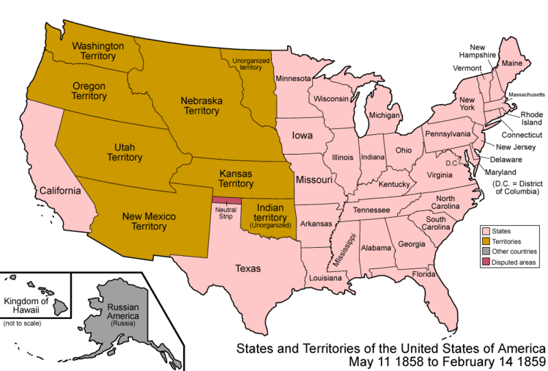
Descripción: Map of the states and territories of the United States as it was from 1858 to 1859. On May 11 1858, part of Minnesota Territory was admitted as the state of Minnesota, the remainder becoming unorganized. On February 14 1859, part of Oregon Territory was admitted as the state of Oregon, the remainder joining on to Washington Territory.
Título: United States 1858-1859
Créditos: Trabajo propio
Autor(a): Made by User:Golbez.
Permiso: Own work, attribution required (Multi-license with GFDL and Creative Commons CC-BY 2.5)
Términos de Uso: Creative Commons Attribution 2.5
Licencia: CC BY 2.5
Enlace de Licencia: https://creativecommons.org/licenses/by/2.5
¿Se exige la atribución?: Sí
Usos del archivo
Las siguientes páginas enlazan a este archivo:

Todo el contenido de los artículos de la Enciclopedia Kiddle (incluidas las imágenes) se puede utilizar libremente para fines personales y educativos bajo la licencia Atribución-CompartirIgual a menos que se indique lo contrario.