
Archivo: Tornado Alley
No disponible en mayor resolución.
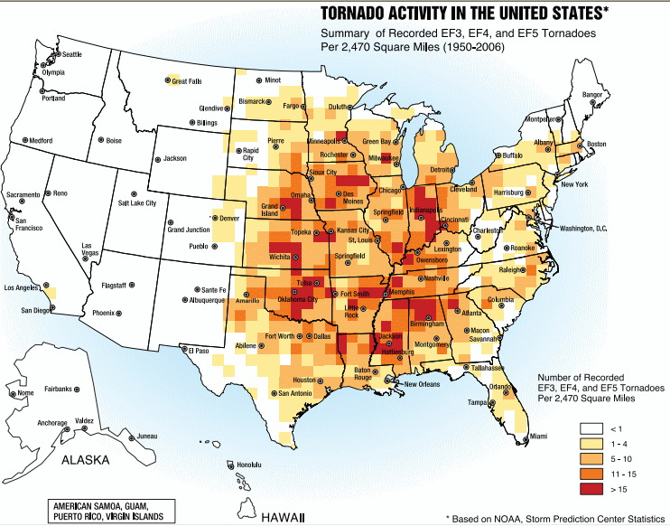
Tornado_Alley.gif (742 × 582 píxeles; tamaño de archivo: 97 KB; tipo MIME: image/gif)
Description: A map of the frequency of F3 and greater intensity tornadoes by area. The darker colors highlight the areas typically known as a Tornado Alley.
Title: Tornado Alley
Credit: Image from Federal Emergency Management Agency, a United States government agency, booklet FEMA 320 Third Edition, Section 1, Figure 1.1, page 3, titled Taking Shelter from the Storm: Building a Safe Room Inside your House
Author: FEMA personnel
Usage Terms: Public domain
License: Public domain
Attribution Required?: No
Usos del archivo
Las siguientes páginas enlazan a este archivo:

Todo el contenido de los artículos de la Enciclopedia Kiddle (incluidas las imágenes) se puede utilizar libremente para fines personales y educativos bajo la licencia Atribución-CompartirIgual a menos que se indique lo contrario.