
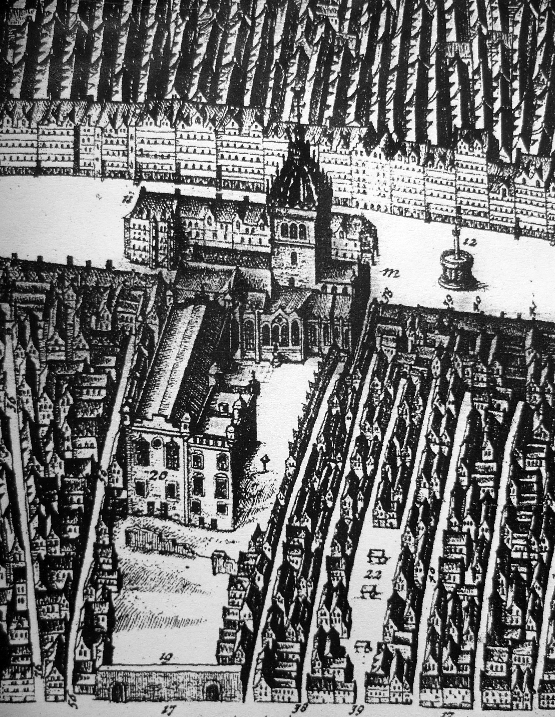
Archivo: St. Giles and Parliament House c.1647
Tamaño de esta previsualización: 464 × 600 píxeles. Otras resoluciones: 186 × 240 píxeles | 1913 × 2472 píxeles.
Archivo original (1913 × 2472 píxeles; tamaño de archivo: 1,73 MB; tipo MIME: image/jpeg)
Description: St. Giles Kirk and Parliament House from James Gordon of Rothiemay's map of Edinburgh 1647. The building beyond St. Giles is the row of open-fronted shops called the Luckenbooths. The town's tolbooth occupied the left end of the row.
Title: St. Giles and Parliament House c.1647
Credit: James Gordon of Rothiemay's map of Edinburgh 1647
Author: James Gordon of Rothiemay
Usage Terms: Public domain
License: Public domain
Attribution Required?: No
Usos del archivo
Las siguientes páginas enlazan a este archivo:

Todo el contenido de los artículos de la Enciclopedia Kiddle (incluidas las imágenes) se puede utilizar libremente para fines personales y educativos bajo la licencia Atribución-CompartirIgual a menos que se indique lo contrario.