
Archivo: Roman Republic Empire map
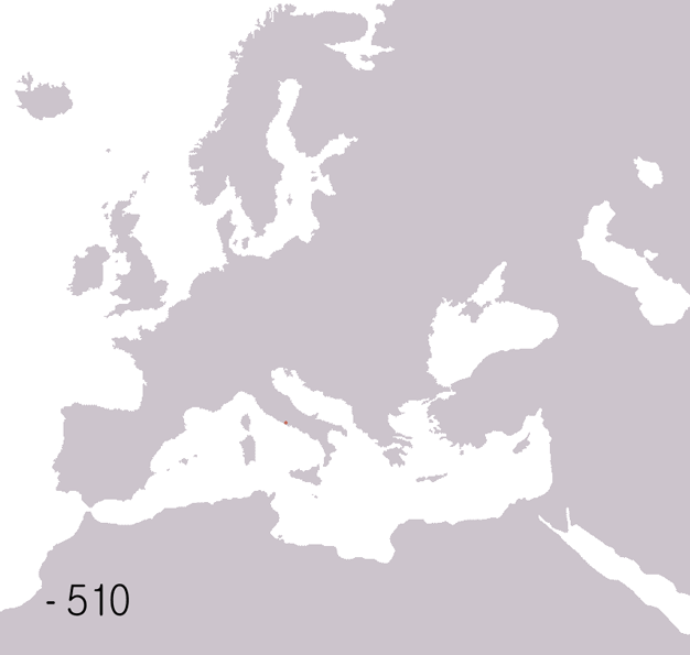
Description: English: Animated map of the Roman Republic and Empire. Displayed in the map: Roman republic 510BC-40BC Roman Empire AD20-AD360 Eastern Roman Empire AD405-AD1453 Western Roman Empire AD405-AD480 Years shown: 510BC, 320BC, 300BC, 270BC, 220BC, 190BC, 140BC, 70BC, 40BC, AD20, AD70, AD140, AD230, AD300, AD360, AD405, AD420, AD450, AD480, AD530.
Title: Roman Republic Empire map
Credit: English: Background map based on Image:BlankMap-Europe-v3.png Data from: Colin McEvedy, Penguin Atlas of Ancient History John Haywood, Atlas of Past Times DK Atlas of world history detailed Roman empire Expansion map at Uni of Texas See also maps at external links, four stage animated map of the roman empire, more detailed animated map of roman empire
Author: Roke (d)
Usage Terms: Creative Commons Attribution-Share Alike 3.0
License: CC-BY-SA-3.0
License Link: http://creativecommons.org/licenses/by-sa/3.0/
Attribution Required?: Yes
Usos del archivo
Las siguientes páginas enlazan a este archivo:
