
Archivo: Patagonia Snow
Tamaño de esta previsualización: 463 × 599 píxeles. Otras resoluciones: 185 × 240 píxeles | 850 × 1100 píxeles.
Archivo original (850 × 1100 píxeles; tamaño de archivo: 903 KB; tipo MIME: image/jpeg)
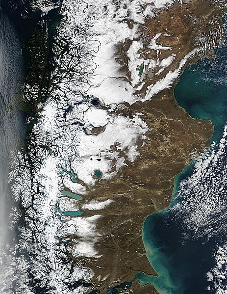
Descripción: Snow runs down the spine of the Andes Mountains along the southern tip of South America. Chile is on the left, and Argentina is on the right. The water cutting across the continent in the bottom center of the image is the Strait of Magellan, once the only safe route between the Atlantic and the Pacific Oceans. Along the coast of Argentina, waters of the Atlantic Ocean are tinted green with sediment.
Título: Patagonia Snow
Créditos: http://visibleearth.nasa.gov/view_rec.php?id=6061
Autor(a): Jacques Descloitres, MODIS Rapid Response Team, NASA/GSFC
Términos de Uso: Dominio Público
Licencia: Dominio Público
¿Se exige la atribución?: No
Usos del archivo
Las siguientes páginas enlazan a este archivo:

Todo el contenido de los artículos de la Enciclopedia Kiddle (incluidas las imágenes) se puede utilizar libremente para fines personales y educativos bajo la licencia Atribución-CompartirIgual a menos que se indique lo contrario.