
Archivo: Mayamap
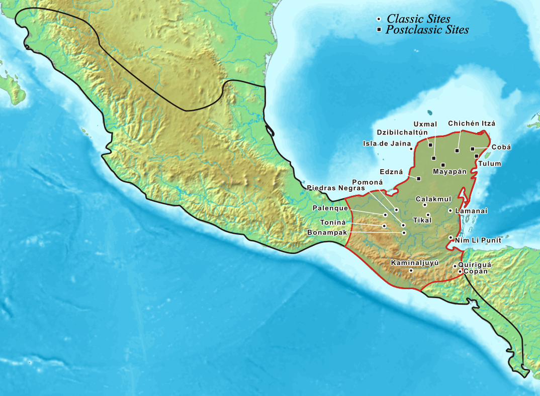
Description: Map showing the extent of the Maya civilization (red), compared to all other Mesoamerica cultures (black). Within Central America and southern North America (Mexico). This map also shows the cities and cultural mainsteads of the Maya, who did not have an empire but rather a group of loosely associated city-states.
Title: Mayamap
Credit: Foster, Lynn (2002). Handbook to Life in the Ancient Maya World. New York, US: Oxford University Press. ISBN 978-0-19-518363-4. OCLC 57319740. Page 4. Sharer, Robert J.; Loa P. Traxler (2006). The Ancient Maya (6th (fully revised) ed.). Stanford, California, US: Stanford University Press. ISBN 0-8047-4817-9. OCLC 57577446. Page 24.
Author: Kmusser
Usage Terms: Creative Commons Attribution-Share Alike 3.0
License: CC-BY-SA-3.0
License Link: http://creativecommons.org/licenses/by-sa/3.0/
Attribution Required?: Yes
Usos del archivo
