
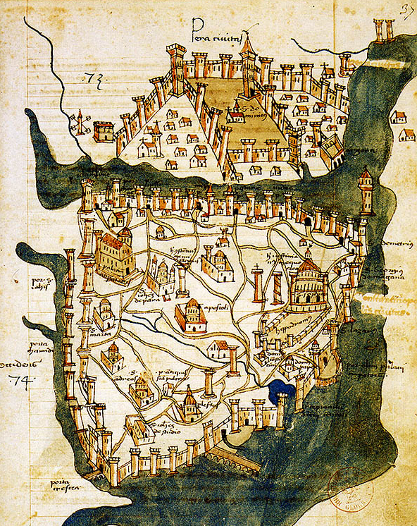
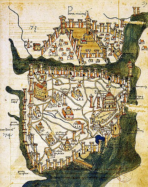
Archivo: Map of Constantinople (1422) by Florentine cartographer Cristoforo Buondelmonte
Description: Map of Constantinople (modern Istanbul), designed in 1422 by Florentine cartographer Cristoforo Buondelmonti (Description des îles de l'archipel, Bibliothèque nationale, Paris) is the oldest surviving map of the city, and the only surviving map which predates the Turkish conquest of Constantinople in 1453.
Title: Map of Constantinople (1422) by Florentine cartographer Cristoforo Buondelmonte
Credit: Liber insularum Archipelagi (1824), version available at the Bibliothèque nationale de France, Paris
Author: Cristoforo Buondelmonti
Permission: This work is in the public domain in its country of origin and other countries and areas where the copyright term is the author's life plus 100 years or less. You must also include a United States public domain tag to indicate why this work is in the public domain in the United States. This file has been identified as being free of known restrictions under copyright law, including all related and neighboring rights.
Usage Terms: Public domain
License: Public domain
Attribution Required?: No
Usos del archivo
Las siguientes páginas enlazan a este archivo:
_by_Florentine_cartographer_Cristoforo_Buondelmonte.jpg&oldid=1278368)

_by_Florentine_cartographer_Cristoforo_Buondelmonte.jpg)