
Archivo: ElectoralCollege2008

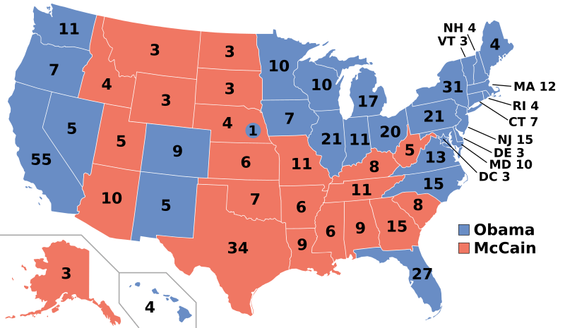
Description: Electoral college map for the 2008 United States presidential election (note: Nebraska and Maine split their EVs by congressional district). Please only update the map when a state is projected SAFE after the final polling place is closed. Do not crystal ball the results. Wait until at least three news organizations call a state before changing the colour: see Pollster.com to see who has called what. Sources used: Pollster.com, CNN.com, MSNBC.com, AP.org, FOXNews.com, and the Omaha World Herald
Title: ElectoralCollege2008
Credit: Own work
Author: Gage
Permission: I, the copyright holder of this work, release this work into the public domain. This applies worldwide. In some countries this may not be legally possible; if so: I grant anyone the right to use this work for any purpose, without any conditions, unless such conditions are required by law.
Usage Terms: Public domain
License: Public domain
Attribution Required?: No
Usos del archivo
Las siguientes páginas enlazan a este archivo:
