
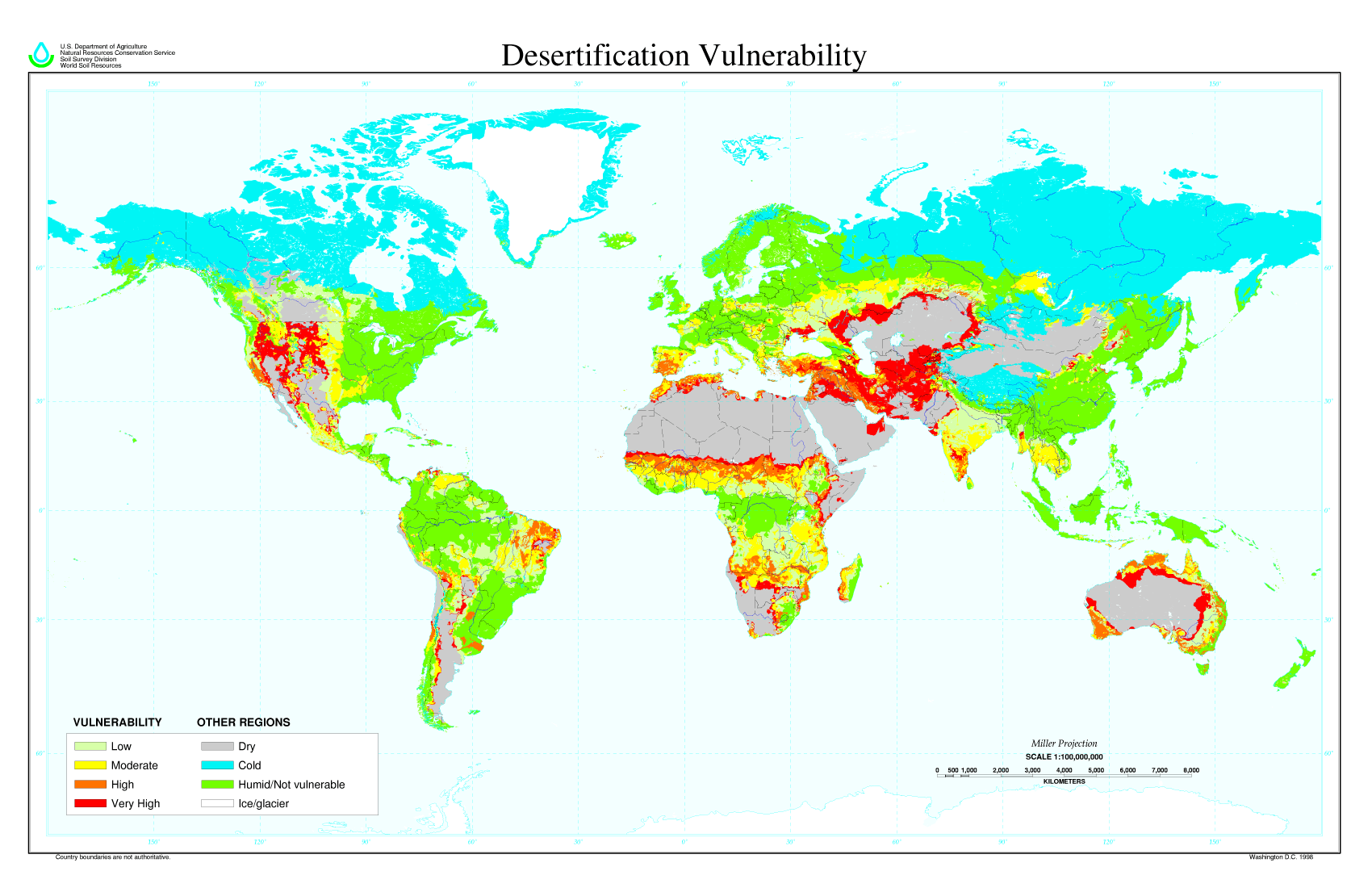
Archivo: Desertification map
Description: Global Desertification Vulnerability Map About the Map: The Desertification Vulnerability map is based on a reclassification of the global soil climate map and global soil map. Possible Uses of the Map: Useful for teachers and students who are interested in the global distribution of desertification vulnerability. Global modelers may be able to use the data for small scale analysis.
Title: Desertification map
Credit: http://www.nrcs.usda.gov/wps/portal/nrcs/detail/national/nedc/training/soil/?cid=nrcs142p2_054003
Author: USDA employee
Permission: This image is a work of a United States Department of Agriculture employee, taken or made during the course of the person's official duties. As a work of the U.S. federal government, the image is in the public domain.
Usage Terms: Public domain
License: Public domain
Attribution Required?: No
Usos del archivo
Las siguientes páginas enlazan a este archivo:
