
Archivo: Chicxulub radar topography
Tamaño de esta previsualización: 536 × 599 píxeles. Otras resoluciones: 215 × 240 píxeles | 715 × 799 píxeles.
Archivo original (715 × 799 píxeles; tamaño de archivo: 119 KB; tipo MIME: image/jpeg)
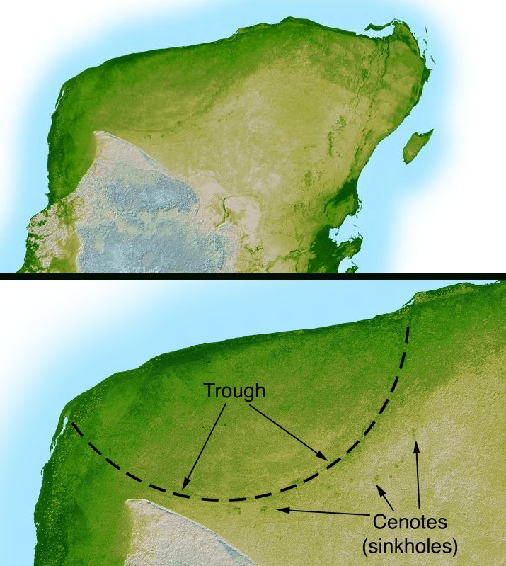
Description: This shaded relief image of Mexico's Yucatan Peninsula show a subtle, but unmistakable, indication of the Chicxulub impact crater. Most scientists now agree that this impact was the cause of the Cretatious-Tertiary Extinction, the event 65 million years ago that marked the sudden extinction of the dinosaurs as well as the majority of life then on Earth.
Title: Chicxulub radar topography
Credit: http://photojournal.jpl.nasa.gov/catalog/PIA03379 Transferred from en.wikipedia to Commons.
Author: NASA/JPL-Caltech
Usage Terms: Public domain
License: Public domain
Attribution Required?: No
Usos del archivo
Las siguientes páginas enlazan a este archivo:

Todo el contenido de los artículos de la Enciclopedia Kiddle (incluidas las imágenes) se puede utilizar libremente para fines personales y educativos bajo la licencia Atribución-CompartirIgual a menos que se indique lo contrario.