
Archivo: Barentsz arctic map
No disponible en mayor resolución.
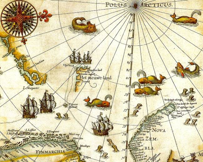
Barentsz_arctic_map.jpg (650 × 517 píxeles; tamaño de archivo: 102 KB; tipo MIME: image/jpeg)
Description: Portion of 1599 map of Arctic exploration by Willem Barentsz. Spitsbergen, here mapped for the first time, is indicated as "Het Nieuwe Land" (Dutch for "the New Land"), center-left.
Title: Barentsz arctic map
Credit: University Library of Tromsø
Author: Willem Barentsz.
Permission: Public domain (over 70 years since creator's death)
Usage Terms: Public domain
License: Public domain
Attribution Required?: No
Usos del archivo
Las siguientes páginas enlazan a este archivo:

Todo el contenido de los artículos de la Enciclopedia Kiddle (incluidas las imágenes) se puede utilizar libremente para fines personales y educativos bajo la licencia Atribución-CompartirIgual a menos que se indique lo contrario.