
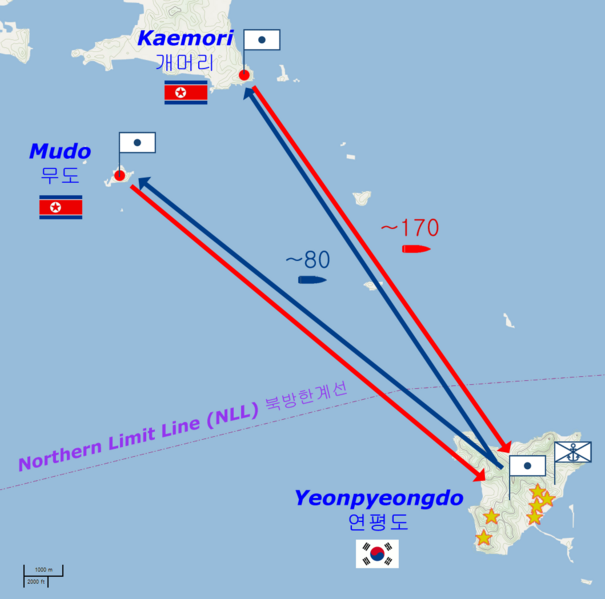
Archivo: Yeonpyeong shelling

Tamaño de esta previsualización: 605 × 599 píxeles. Otras resoluciones: 242 × 240 píxeles | 1059 × 1049 píxeles.
Archivo original (1059 × 1049 píxeles; tamaño de archivo: 62 KB; tipo MIME: image/png)
Description: Map of the Yeonpyeong shelling of 23 November 2010.
Title: Yeonpyeong shelling
Credit: Basic map is from OpenStreetMaps (Cycle Map layer); names and locations from National Geospatial-Intelligence Agency database; other geographical detail is from Kukinews [1], Gong-gam Korea [2] and The Hangyoreh [3]
Author: base map: © OpenStreetMap und Mitwirkende, CC-BY-SA derivative work: Prioryman (talk)
Usage Terms: Creative Commons Attribution-Share Alike 2.0
License: CC BY-SA 2.0
License Link: http://creativecommons.org/licenses/by-sa/2.0
Attribution Required?: Yes
Usos del archivo
La siguiente página enlaza a este archivo:

Todo el contenido de los artículos de la Enciclopedia Kiddle (incluidas las imágenes) se puede utilizar libremente para fines personales y educativos bajo la licencia Atribución-CompartirIgual a menos que se indique lo contrario.