
Archivo: World ocean map
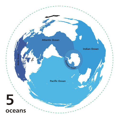
Description: Animated world ocean map (GIF), exhibiting various oceans. Azimuthal distance projection map is based on world map from this online Java tool by Henry Bottomley and altered using CorelDraw/PhotoPaint, et al. Map is centered on 85° W, 45° S, rotated 90° CCW (North Pole is to the left). Ocean boundaries per International Hydrographic Organisation. blue: ocean black: other substantial bodies of water (viz. Caspian Sea, Great Lakes) red: land green dotted line: map periphery
Title: World ocean map
Credit: Own work based on Image:Oceans.png and animated design inspired by Image:Continental models.gif.
Author: User:Quizimodo
Permission: I, the copyright holder of this work, release this work into the public domain. This applies worldwide. In some countries this may not be legally possible; if so: I grant anyone the right to use this work for any purpose, without any conditions, unless such conditions are required by law.
Usage Terms: Public domain
License: Public domain
Attribution Required?: No
Usos del archivo
Las siguientes páginas enlazan a este archivo:
