
Archivo: Willem Blaeu00
Tamaño de esta previsualización: 786 × 600 píxeles. Otras resoluciones: 315 × 240 píxeles | 1140 × 870 píxeles.
Archivo original (1140 × 870 píxeles; tamaño de archivo: 399 KB; tipo MIME: image/jpeg)
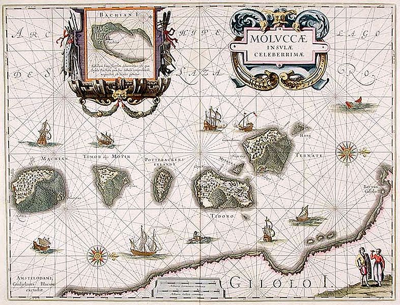
Description: "Moluccæ Insulæ Celeberrimæ". Blaeu's map, which first appeared in 1630 in the Atlantis Appendix., was the first large-scale, detailed map of the now Dutch-controlled islands. It shows the heavily forested nature of the islands and the recently constructed forts. North is on the right direction, with Ternate in the rightmost island followed by Tidore, Mare, Moti and Makian islands. The bottom is the Gilolo (Jailolo or Halmahera) Island. Inset on the top is Bacan Island.
Title: Willem Blaeu00
Credit: http://www.donaldheald.com/s12772.html
Author: Willem Janszoon Blaeu (1571-1638)
Permission: Public domain
Usage Terms: Public domain
License: Public domain
Attribution Required?: No
Usos del archivo
Las siguientes páginas enlazan a este archivo:

Todo el contenido de los artículos de la Enciclopedia Kiddle (incluidas las imágenes) se puede utilizar libremente para fines personales y educativos bajo la licencia Atribución-CompartirIgual a menos que se indique lo contrario.