
Archivo: WWII-Mediterranean-v1
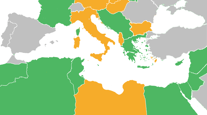
Descripción: Map with the Participants in World War II: Dark Green: Allies before the attack on Pearl Harbor, including colonies and occupied countries. Light Green: Allied countries that entered the war after the Japanese attack on Pearl Harbor. Orange: Axis Powers Gray: Neutral countries during WWII Light green dots represent countries that later in the war changed from the Axis to the Allies Orange dots represent countries that after being conquered by the Axis Powers, became puppets of those (Vichy France and several French colonies, Croatia, Greece)
Título: WWII-Mediterranean-v1
Créditos: derived from Image:BlankMap-World6.svg
Autor(a): derived from User:Canuckguy's map
Términos de Uso: Creative Commons Attribution-Share Alike 3.0
Licencia: CC-BY-SA-3.0
Enlace de Licencia: http://creativecommons.org/licenses/by-sa/3.0/
¿Se exige la atribución?: Sí
Usos del archivo
La siguiente página enlaza a este archivo:
