
Archivo: United States 1860-1861-01
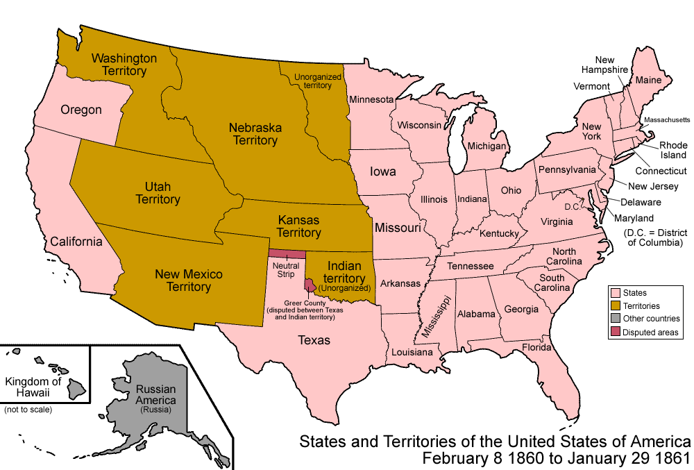
Descripción: Map of the states and territories of the United States as it was from 1860 to January 1861. On February 8 1860, a dispute arose between Texas and the federal government over ownership of Greer County. On January 29 1861, the eastern portion of Kansas Territory was admitted as the state of Kansas; the western portion seems to have had no official definition for roughly a month, as it was not transferred to Colorado Territory until February 28 1861. During this period, it was de facto under the control of the self-proclaimed Territory of Jefferson.
Título: United States 1860-1861-01
Créditos: Trabajo propio
Autor(a): Made by User:Golbez.
Permiso: Own work, attribution required (Multi-license with GFDL and Creative Commons CC-BY 2.5)
Términos de Uso: Creative Commons Attribution 2.5
Licencia: CC BY 2.5
Enlace de Licencia: https://creativecommons.org/licenses/by/2.5
¿Se exige la atribución?: Sí
Usos del archivo
La siguiente página enlaza a este archivo:
