
Archivo: United States 1792-06-1795
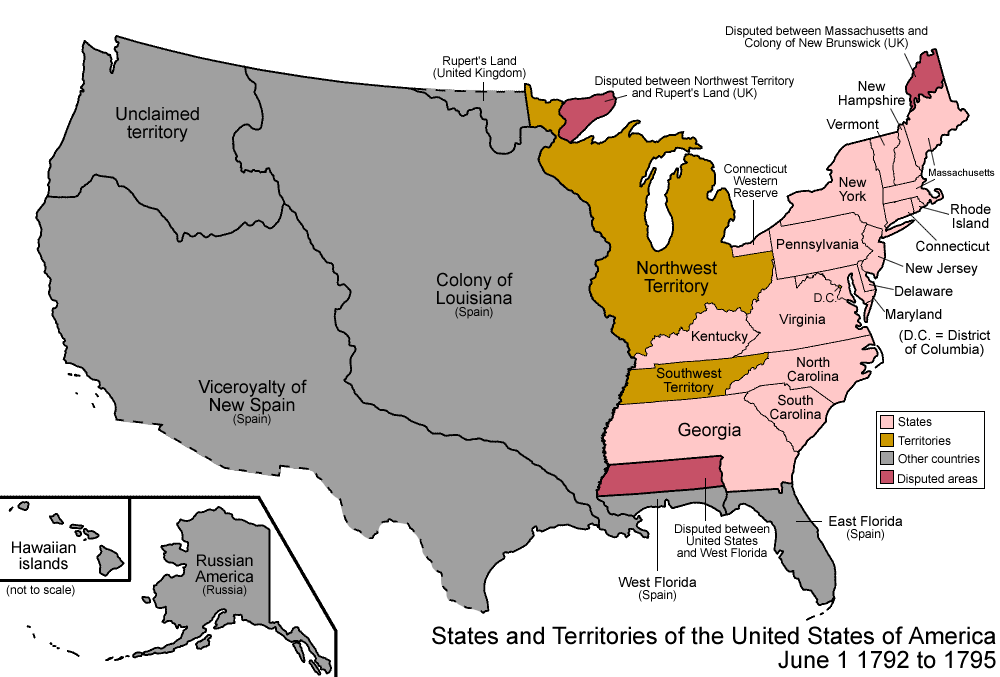
Descripción: Map of the states and territories of the United States as it was from 1792 to 1795. On June 1 1792, nine western counties were split off from Virginia and admitted as the state of Kentucky. On October 27, 1795 Spain and the United States signed "Pinckney's Treaty," which resolved—in the United States' favor—a territorial dispute over the part of Spanish West Florida between 31°N and 32° 22′. The treaty became effective on August 3, 1796.
Título: United States 1792-06-1795
Créditos: Trabajo propio
Autor(a): Made by User:Golbez.
Permiso: Own work, attribution required (Multi-license with GFDL and Creative Commons CC-BY 2.5)
Términos de Uso: Creative Commons Attribution 2.5
Licencia: CC BY 2.5
Enlace de Licencia: https://creativecommons.org/licenses/by/2.5
¿Se exige la atribución?: Sí
Usos del archivo
La siguiente página enlaza a este archivo:
