
Archivo: United Bengal
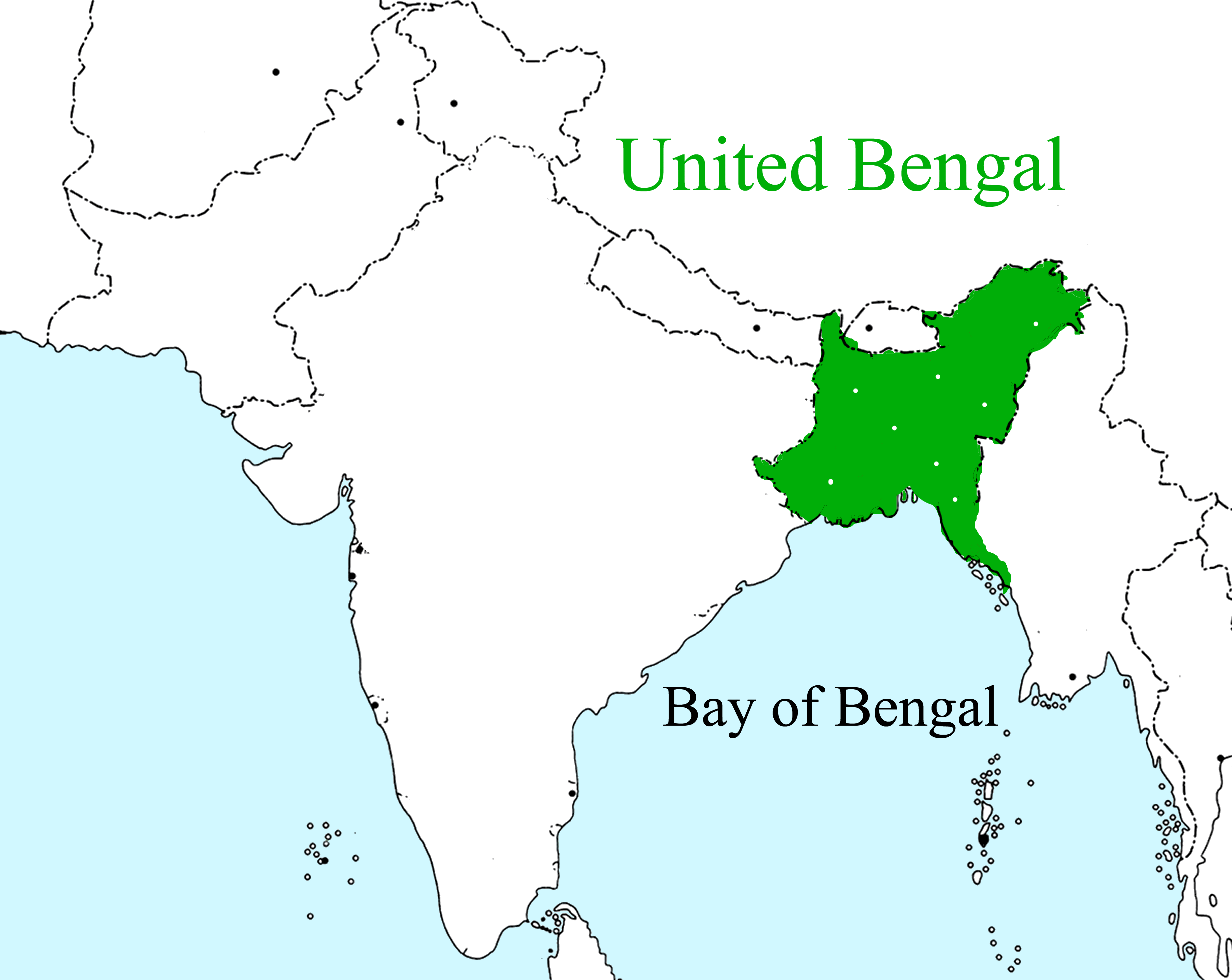
Description: This is the historical map of united Bengal and Bengali speaking region of South Asia. The Bengal region lies in the Ganges-Brahmaputra delta, but there are highlands in its north, northeast, and southeast. Politically, Bengal is now divided between the sovereign Republic of Bangladesh, and India,s West Bengal, Tripura, and Asam. This map region is the map of Bengal Sultanate before the Battle of Plassey. The United Bengal proposal was formally made by the Last Prime minister of British Ruled Bengal Huseyn Shaheed Suhrawardy and Bengali Nationalist Sharat Chandra Bose in 1947.
Title: United Bengal
Credit: Own work
Author: Aziz Tarak.
Permission: This work is free and may be used by anyone for any purpose. If you wish to use this content, you do not need to request permission as long as you follow any licensing requirements mentioned on this page. Wikimedia Foundation has received an e-mail confirming that the copyright holder has approved publication under the terms mentioned on this page. This correspondence has been reviewed by an OTRS member and stored in our permission archive. The correspondence is available to trusted volunteers as ticket #2017042610024422. If you have questions about the archived correspondence, please use the OTRS noticeboard.
Usage Terms: Creative Commons Attribution-Share Alike 4.0
License: CC BY-SA 4.0
License Link: https://creativecommons.org/licenses/by-sa/4.0
Attribution Required?: Yes
Usos del archivo
La siguiente página enlaza a este archivo:
