
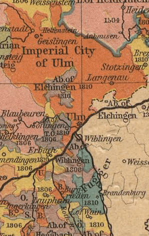
Archivo: Ulm-Wiblingen-Fugger
No disponible en mayor resolución.
Ulm-Wiblingen-Fugger.png (298 × 473 píxeles; tamaño de archivo: 119 KB; tipo MIME: image/png)
Descripción: Map showing the Imperial Free City of Ulm, Wiblingen and Elchingen Imperial Abbeys and County of Fugger, with the Danube shown running through the centre of the image.
Título: Ulm-Wiblingen-Fugger
Créditos: Cropped from German States Before and since the French Revolution: II. Wurtemberg, from The Historical Atlas by William R. Shepherd, 1923, from the Perry-Castañeda map collection
Autor(a): OwenBlacker
Términos de Uso: Dominio Público
Licencia: Dominio Público
¿Se exige la atribución?: No
Usos del archivo
La siguiente página enlaza a este archivo:

Todo el contenido de los artículos de la Enciclopedia Kiddle (incluidas las imágenes) se puede utilizar libremente para fines personales y educativos bajo la licencia Atribución-CompartirIgual a menos que se indique lo contrario.