
Archivo: Ukraine famine map

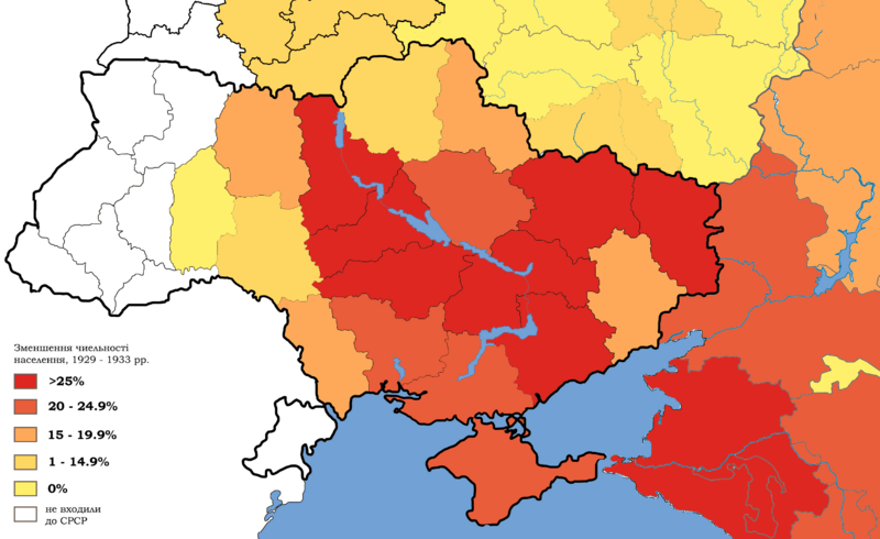
Descripción: Depopulation in Ukraine and southern Russia, 1929 – 1933. White regions were not part of the USSR at that time.
Título: Ukraine famine map
Créditos: Trabajo propio, based on: File:Map_of_Ukraine_political_simple_blank.png, File:Belarus_provinces_blank.png, File:Outline_Map_of_Central_Russia.svg, File:Ouline_Map_of_Southern_Federal_District.svg, statistics from "The Foreign Office and the famine : British documents on Ukraine and the Great Famine of 1932-1933" / edited by Marco Carynnyk, Lubomyr Y. Luciuk and Bohdan S. Kordan ; with a foreword by Michael R. Marrus. Kingston, Ont. ; Vestal, N.Y. : Limestone Press, 1988. lxi, 493 p. ; 24 p. ISBN 0919642314
Autor(a): Sergento
Términos de Uso: Creative Commons Attribution-Share Alike 4.0
Licencia: CC BY-SA 4.0
Enlace de Licencia: https://creativecommons.org/licenses/by-sa/4.0
¿Se exige la atribución?: Sí
Usos del archivo
La siguiente página enlaza a este archivo:
