
Archivo: US SlaveFree1789
No disponible en mayor resolución.
US_SlaveFree1789.gif (774 × 468 píxeles; tamaño de archivo: 20 KB; tipo MIME: image/gif)
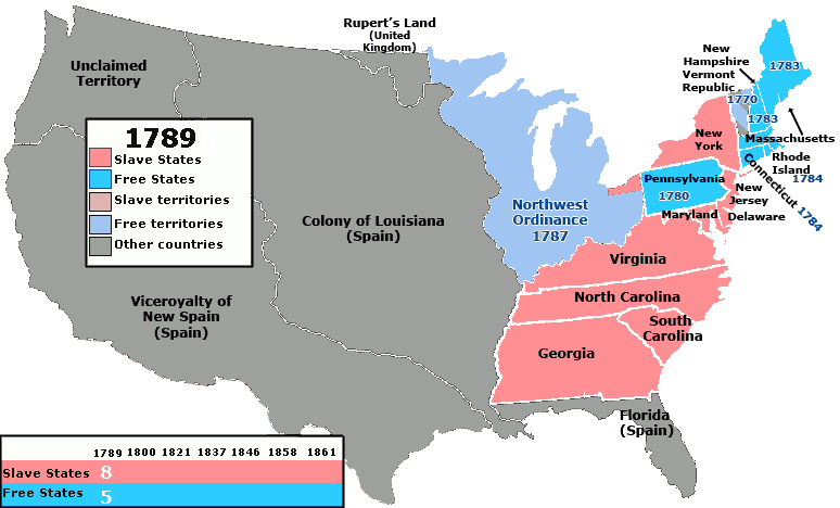
Description: Map of the states and territories of the United States as it was from March 1789 to August 1789 showing which areas of the United States did and did not allow slavery. Territories and states which had not specifically banned slavery are colored red/pink.
Title: US SlaveFree1789
Credit: United_States_1789-03-1789-08.png
Author: United_States_1789-03-1789-08.png: Made by User:Golbez. derivative work: Kenmayer (talk)
Usage Terms: Creative Commons Attribution 2.5
License: CC BY 2.5
License Link: http://creativecommons.org/licenses/by/2.5
Attribution Required?: Yes
Usos del archivo
La siguiente página enlaza a este archivo:

Todo el contenido de los artículos de la Enciclopedia Kiddle (incluidas las imágenes) se puede utilizar libremente para fines personales y educativos bajo la licencia Atribución-CompartirIgual a menos que se indique lo contrario.