
Archivo: Typhoon Haiyan 2013 making landfall
No disponible en mayor resolución.
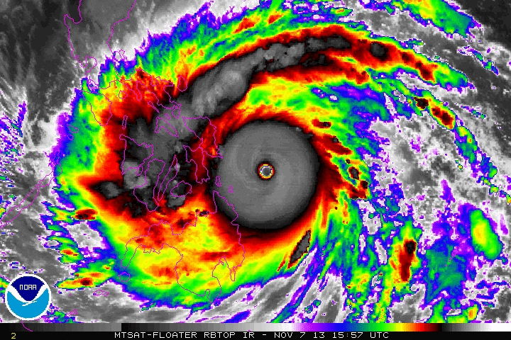
Typhoon_Haiyan_2013_making_landfall.gif (720 × 480 píxeles; tamaño de archivo: 3,9 MB; tipo MIME: image/gif, bucleado, 15 frames, 3,1s)
Description: The animation presents an enhanced infrared satellite loop of Typhoon Haiyan (also known as Typhoon Yolanda in the Philippines) from 15:57 UTC to 22:57 UTC on November 7, 2013. These images show the storm at peak intensity and making landfall over the islands of Samar and Leyte in the Philippines.
Title: Typhoon Haiyan 2013 making landfall
Credit: http://www.ssd.noaa.gov/PS/TROP/floaters/
Author: National Oceanic and Atmospheric Administration Satellite Services Division
Usage Terms: Public domain
License: Public domain
Attribution Required?: No
Usos del archivo
La siguiente página enlaza a este archivo:

Todo el contenido de los artículos de la Enciclopedia Kiddle (incluidas las imágenes) se puede utilizar libremente para fines personales y educativos bajo la licencia Atribución-CompartirIgual a menos que se indique lo contrario.