
Archivo: Turbid Waters Surround New Zealand - crop
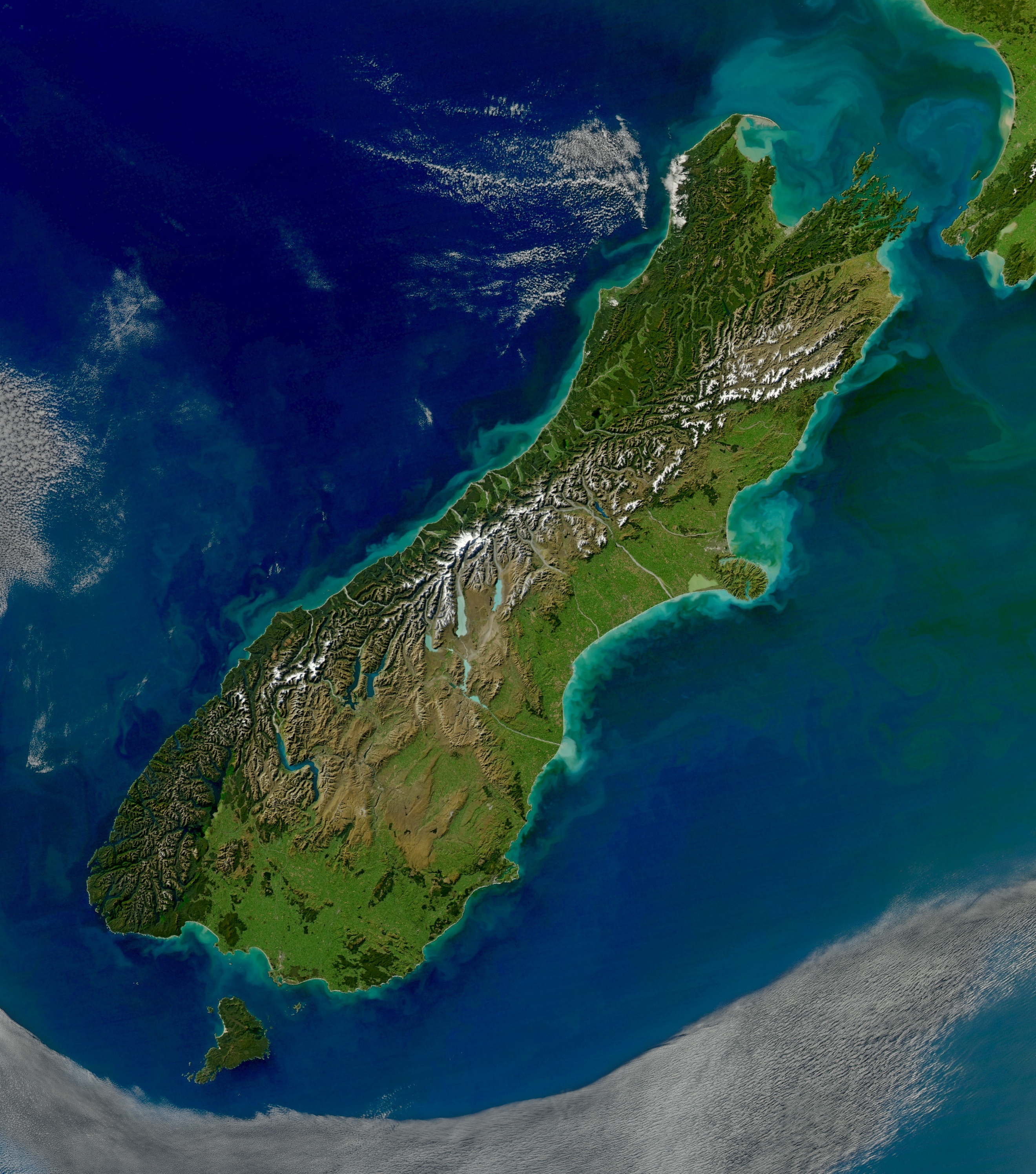
Description: View of sediment from New Zealand's South Island flowing in the Pacific Ocean. The volume of sediment in the water hints at rough seas. Distinctive plumes arise from pulsing rivers, while the halo of turquoise around both islands is likely sediment swept up to the ocean surface by powerful waves. The plumes fan out and fade from tan to green and blue with water depth and distance from the shore. The Cook Strait, the narrow strip of water separating the North and South Islands of New Zealand, has a reputation for being among the world’s roughest stretches of water. The islands lie within the “Roaring Forties,” a belt of winds that circles the globe around 40 degrees south. The westerlies hit the islands side on and run into the mountain ranges. The Cook Strait is the only opening for the winds, so the channel becomes something of a wind tunnel. Strong winds produce high waves, and they erode the shore as shown in the image.
Title: Turbid Waters Surround New Zealand - crop
Credit: This file was derived from Turbid Waters Surround New Zealand.jpg:
Author: Turbid_Waters_Surround_New_Zealand.jpg: Norman Kuring derivative work (a simple crop): Avenue (talk)
Usage Terms: Public domain
License: Public domain
Attribution Required?: No
Usos del archivo
La siguiente página enlaza a este archivo:
