
Archivo: Troyville and Baytown cultures map HRoe 2011
No disponible en mayor resolución.
Troyville_and_Baytown_cultures_map_HRoe_2011.jpg (600 × 494 píxeles; tamaño de archivo: 300 KB; tipo MIME: image/jpeg)
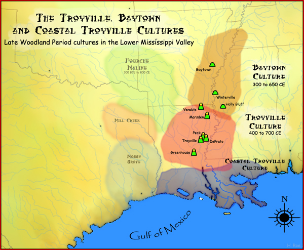
Description: A map showing the geographical extent of the Troyville, Coastal Troyville and Baytown cultures during the Late Woodland period in the Southern United States, and some of its important sites.
Title: Troyville and Baytown cultures map HRoe 2011
Credit: Own work
Author: Herb Roe
Usage Terms: Creative Commons Attribution-Share Alike 3.0
License: CC BY-SA 3.0
License Link: http://creativecommons.org/licenses/by-sa/3.0
Attribution Required?: Yes
Usos del archivo
La siguiente página enlaza a este archivo:

Todo el contenido de los artículos de la Enciclopedia Kiddle (incluidas las imágenes) se puede utilizar libremente para fines personales y educativos bajo la licencia Atribución-CompartirIgual a menos que se indique lo contrario.