
Archivo: Torres Strait txu-pclmaps-oclc-8322829 n 14
Tamaño de esta previsualización: 800 × 515 píxeles. Otras resoluciones: 320 × 206 píxeles | 2122 × 1365 píxeles.
Archivo original (2122 × 1365 píxeles; tamaño de archivo: 1,89 MB; tipo MIME: image/jpeg)
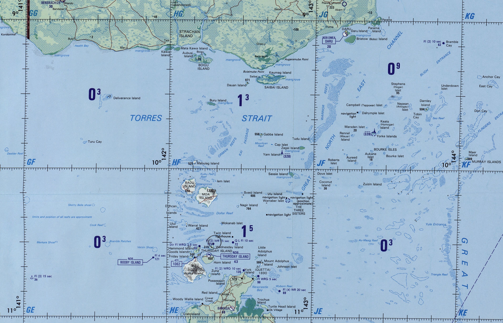
Descripción: Operational Navigational Chart 1:1,000,000 sheet N-14 (cropped for Torres Strait Islands, Queensland, Australia)
Título: Torres Strait txu-pclmaps-oclc-8322829 n 14
Créditos: This image is a copy or a derivative work of txu-pclmaps-oclc-8322829_n_14.jpg, from the map collection of the Perry–Castañeda Library (PCL) of the University of Texas at Austin. This tag does not indicate the copyright status of the attached work. A normal copyright tag is still required. See Commons:Licensing for more information.
Autor(a): U.S. Defense Mapping Agency Aerospace Center
Términos de Uso: Dominio Público
Licencia: Dominio Público
¿Se exige la atribución?: No
Usos del archivo
La siguiente página enlaza a este archivo:

Todo el contenido de los artículos de la Enciclopedia Kiddle (incluidas las imágenes) se puede utilizar libremente para fines personales y educativos bajo la licencia Atribución-CompartirIgual a menos que se indique lo contrario.