
Archivo: Tachiraptor range map
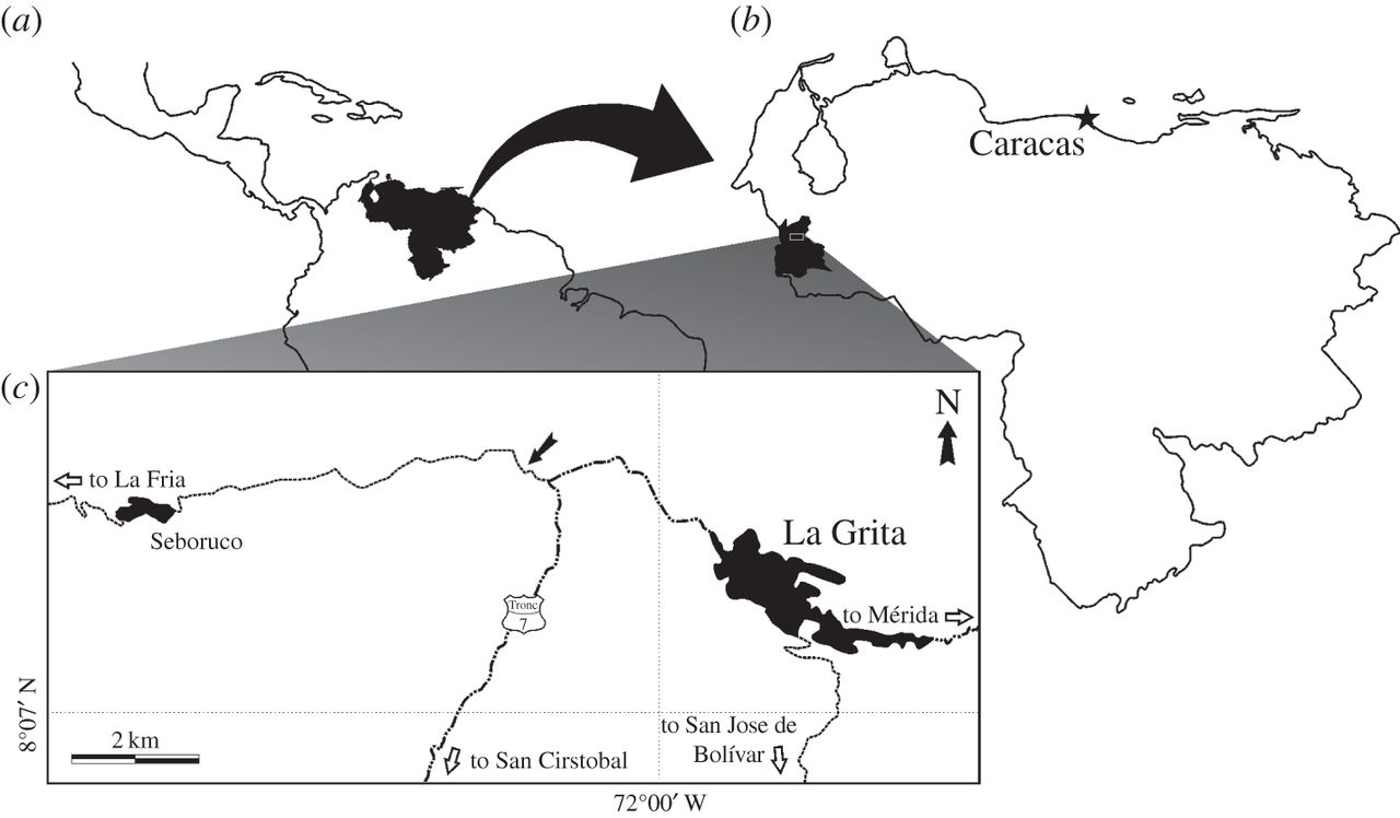
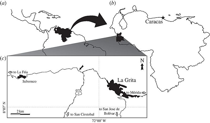
Descripción: Maps of (a) Venezuela within northern South and Central America, (b) Táchira State within Venezuela and (c) La Grita area indicating the location of the type locality of Tachiraptor admirabilis (black arrow). Dash-dotted lines denote main roads; thin dotted lines, paved secondary roads.
Título: Tachiraptor range map
Créditos: New dinosaur (Theropoda, stem-Averostra) from the earliest Jurassic of the La Quinta formation, Venezuelan Andes
Autor(a): Max C. Langer, Ascanio D. Rincón, Jahandar Ramezani, Andrés Solórzano, Oliver W. M. Rauhut
Términos de Uso: Creative Commons Attribution 4.0
Licencia: CC BY 4.0
Enlace de Licencia: https://creativecommons.org/licenses/by/4.0
¿Se exige la atribución?: Sí
Usos del archivo
La siguiente página enlaza a este archivo:
