
Archivo: St Giles & Holborn Civil Parish Map 1870
Tamaño de esta previsualización: 800 × 486 píxeles. Otras resoluciones: 320 × 194 píxeles | 7566 × 4593 píxeles.
Archivo original (7566 × 4593 píxeles; tamaño de archivo: 2,02 MB; tipo MIME: image/png)
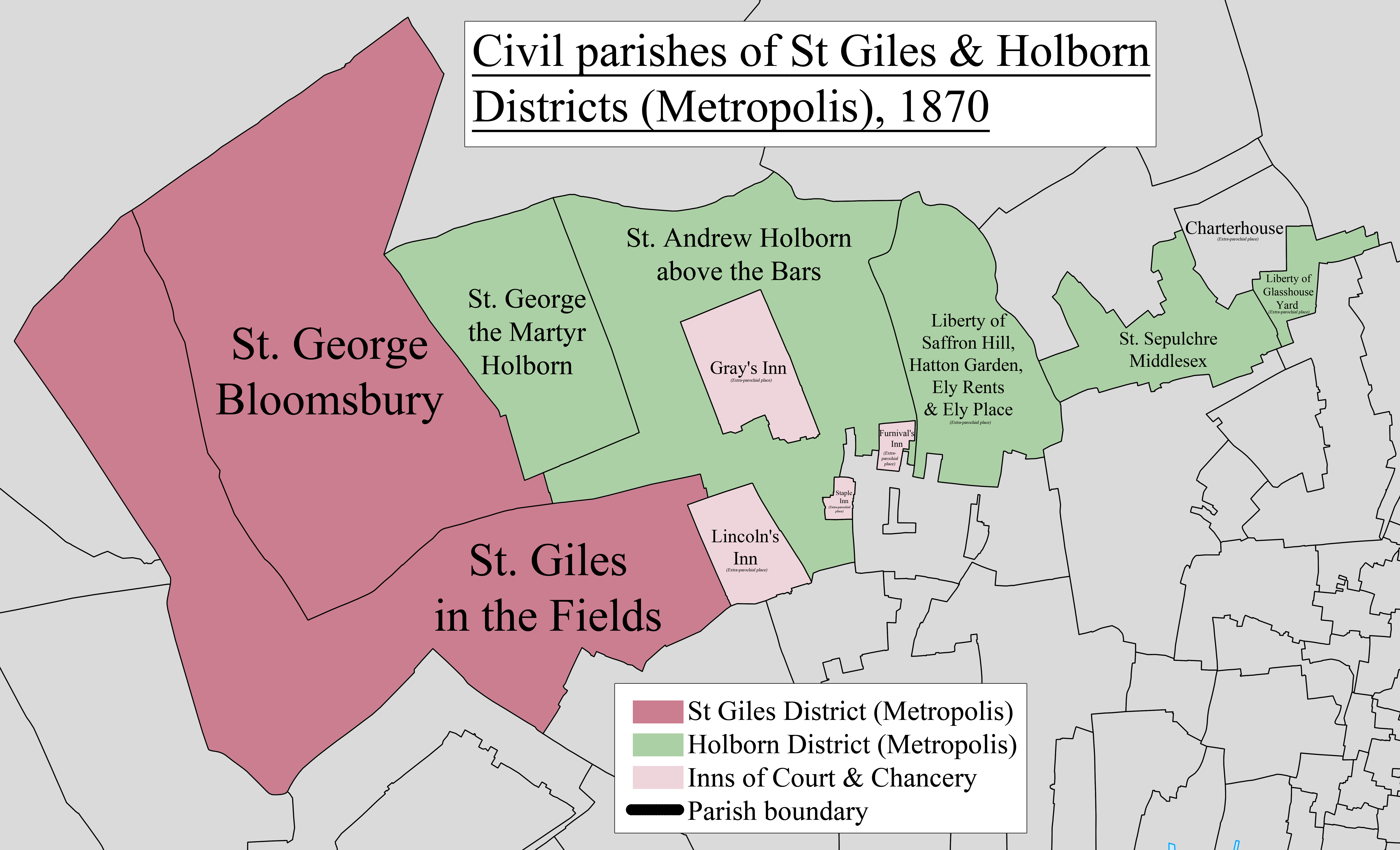
Description: A map showing the civil parishes of the Metropolis districts of St. Giles and Holborn as they appeared in 1870. Based on the Ordnance Survey Town Plan of London (1871-76) at 1:1056 scale.
Title: St Giles & Holborn Civil Parish Map 1870
Credit: Own work
Author: Doc77can
Usage Terms: Creative Commons Attribution-Share Alike 3.0
License: CC BY-SA 3.0
License Link: http://creativecommons.org/licenses/by-sa/3.0
Attribution Required?: Yes
Usos del archivo
La siguiente página enlaza a este archivo:

Todo el contenido de los artículos de la Enciclopedia Kiddle (incluidas las imágenes) se puede utilizar libremente para fines personales y educativos bajo la licencia Atribución-CompartirIgual a menos que se indique lo contrario.