
Archivo: Spanish Missions in Texas
No disponible en mayor resolución.
Spanish_Missions_in_Texas.JPG (552 × 487 píxeles; tamaño de archivo: 27 KB; tipo MIME: image/jpeg)
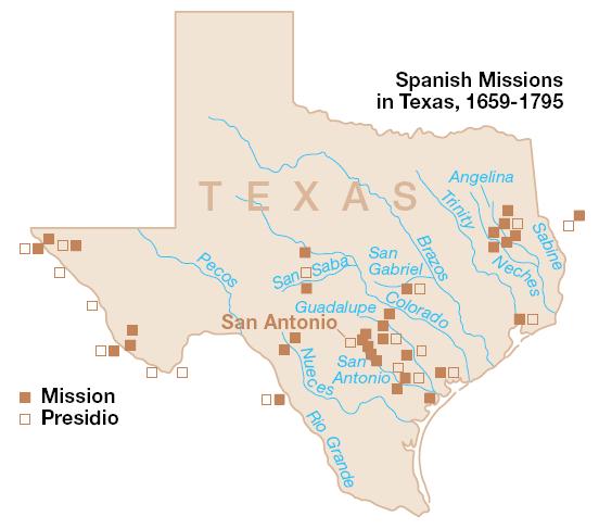
Description: The map depicts the Spanish missions and presidios that were established within the boundaries of present day Texas in the 18th and 19th centuries. The map's range is within the Viceroyalty of New Spain (colonial Mexico), and not limited to the smaller Spanish colonial Province of Tejas (Texas) boundaries. This is a product of the US National Park Service, and was taken from the website: http://www.nps.gov/archive/saan/maps/SAANmap4.pdf.
Title: Spanish Missions in Texas
Usage Terms: Public domain
License: Public domain
Attribution Required?: No
Usos del archivo
Las siguientes páginas enlazan a este archivo:

Todo el contenido de los artículos de la Enciclopedia Kiddle (incluidas las imágenes) se puede utilizar libremente para fines personales y educativos bajo la licencia Atribución-CompartirIgual a menos que se indique lo contrario.