
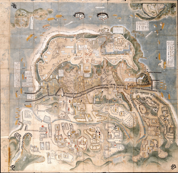
Archivo: Shimabara-Battle-Map-c17th-century

Descripción: This is an Important Cultural Property. A map depicting the Amakusa / Shimabara Rebellion centered on Hara Castle. From the beginning of February in the 15th year of Kanei (1638), when the Kyushu daimyo entered the siege of Hara Castle, the process of the total attack and even the situation after the fall of the castle are depicted. Among the many maps of the Hara Castle attack, the details and accuracy of the description are first-class, and its reputation has been high since the Edo period. The maps shows the Tachibana clan is in the position of Sannomarushita along with the Hosokawa clan. This map is known to be the most accurate of the many drawings depicting the Shimabara Rebellion.
Título: Shimabara-Battle-Map-c17th-century
Créditos: Yanagawa Ancient Archives - https://www.city.yanagawa.fukuoka.jp/blog-buka/2020/_7900/_7933.html
Autor(a): DesconocidoUnknown author
Términos de Uso: Dominio Público
Licencia: Dominio Público
¿Se exige la atribución?: No
Usos del archivo
La siguiente página enlaza a este archivo:
