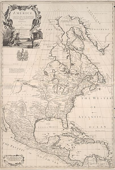
Archivo: Senex, Price, and Maxwell North America 1710 UTA

Description: By here focusing largely upon eastern North America, British map producers Senex, Price, and Maxwell avoided the cartographic problems still associated in the early 18th-century with the depiction of California as an island and the mysterious Northwest Coast which was still largely unknown to Europeans. They copied and translated French mapmaker Delisle's 1703 Carte du Canada ou de la Nouvelle France for the northern part of their map and Delisle's 1703 Carte du Mexique et de la Floride for the southern portion. Surprisingly, the Englishmen even copied the Frenchmen's dotted-line political boundaries, but not surprisingly, they did not credit or mention Delisle. Senex did add a different cartouche. Around 1717 George Whilldey and his engraver H. Terrasson, in turn, copied Senex, Price, and Maxwell's map for Whilldey's Atlas of the World.
Title: North America: corrected from the observations communicated to the Royal Society at London, and the Royal Academy at Paris
Credit: Cartographic Connections: map / text
Author: John Senex
Usage Terms: Public domain
License: Public domain
Attribution Required?: No
Usos del archivo
Las siguientes páginas enlazan a este archivo:

