
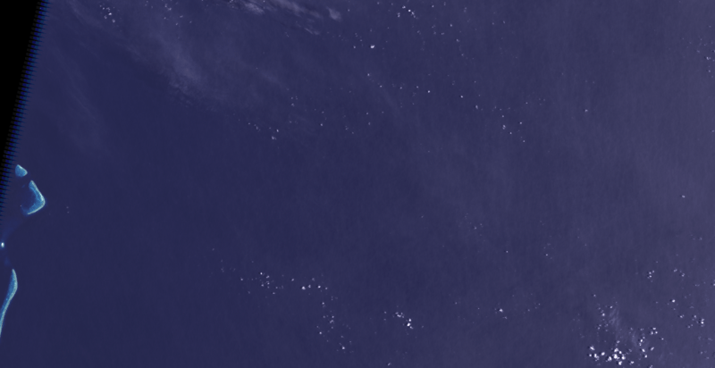
Archivo: Sandy Island (Alleged Location) 2002-01-10, Landsat 7 ETM+
Description: Composite "true color" satellite image of the alleged location of Sandy Island, New Caledonia. Chesterfield Islands are visible to the west. The deepest point that can be discerned in the blue color band, seen near Renard Island (Chesterfield Islands) to the west, is approximately 35m. If Sandy Island were visible in this image, it would be located in the eastern half of the image and would be approximately 850 pixels in height. NASA Landsat 7 ETM+ bands used were 3 (red), 2 (green), 1 (blue), and 8 (panspectral). The image was pan-sharpened, resampled to 30m resolution, and cropped. Imagery courtesy of NASA/USGS.
Title: Sandy Island (Alleged Location) 2002-01-10, Landsat 7 ETM+
Credit: NASA Landsat satellite image GeoTIFF archive, http://glovis.usgs.gov
Author: NASA
Usage Terms: Public domain
License: Public domain
Attribution Required?: No
Usos del archivo
La siguiente página enlaza a este archivo:
_2002-01-10,_Landsat_7_ETM%2B.png&oldid=2352830)

_2002-01-10,_Landsat_7_ETM+.png)