
Archivo: Sahel Map-Africa rough

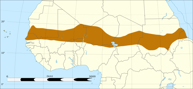
Descripción: Map of Africa, with the Sahel highlighted in orange. This is roughly the African land area between the lines of 200mm (north) and 600mm (south) mean 20th century annual rainfall. This is limited to land areas directly to the south of the Sahara desert and including the islands of Cape Verde, but not including other areas in Africa with the same rainfall statistics. This is one, but not the only, definition of the Sahel region.
Título: Sahel Map-Africa rough
Créditos: Sahel Map-Africa rough.png Africa location map without rivers.svg
Autor(a): Sahel Map-Africa rough.png: T L Miles (discusión · contribs.) Africa location map without rivers.svg: Sting (discusión · contribs.) derivative work: Rowanwindwhistler (discusión)
Términos de Uso: Creative Commons Attribution-Share Alike 4.0
Licencia: CC BY-SA 4.0
Enlace de Licencia: https://creativecommons.org/licenses/by-sa/4.0
¿Se exige la atribución?: Sí
Usos del archivo
