
Archivo: Rheinbund 1806.33
Tamaño de esta previsualización: 507 × 599 píxeles. Otras resoluciones: 203 × 240 píxeles | 2414 × 2854 píxeles.
Archivo original (2414 × 2854 píxeles; tamaño de archivo: 1,38 MB; tipo MIME: image/png)
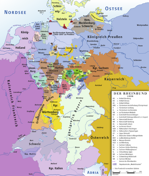
Descripción: Map of the Confederation of the Rhine, 1806
Título: Rheinbund 1806, political map
Créditos: own drawing/Source of Information: Putzger – Historischer Weltatlas, 89. Auflage, 1965; Westermanns Großer Atlas zur Weltgeschichte, 1969; Haacks geographischer Atlas. VEB Hermann Haack Geographisch-Kartographische Anstalt, Gotha/Leipzig, 1. Auflage, 1979.
Autor(a): ziegelbrenner
Permiso: GNU FDL
Términos de Uso: Creative Commons Attribution 2.5
Licencia: CC BY 2.5
Enlace de Licencia: https://creativecommons.org/licenses/by/2.5
¿Se exige la atribución?: Sí
Usos del archivo
El siguiente archivo es un duplicado de éste (más detalles):
La siguiente página enlaza a este archivo:

Todo el contenido de los artículos de la Enciclopedia Kiddle (incluidas las imágenes) se puede utilizar libremente para fines personales y educativos bajo la licencia Atribución-CompartirIgual a menos que se indique lo contrario.