
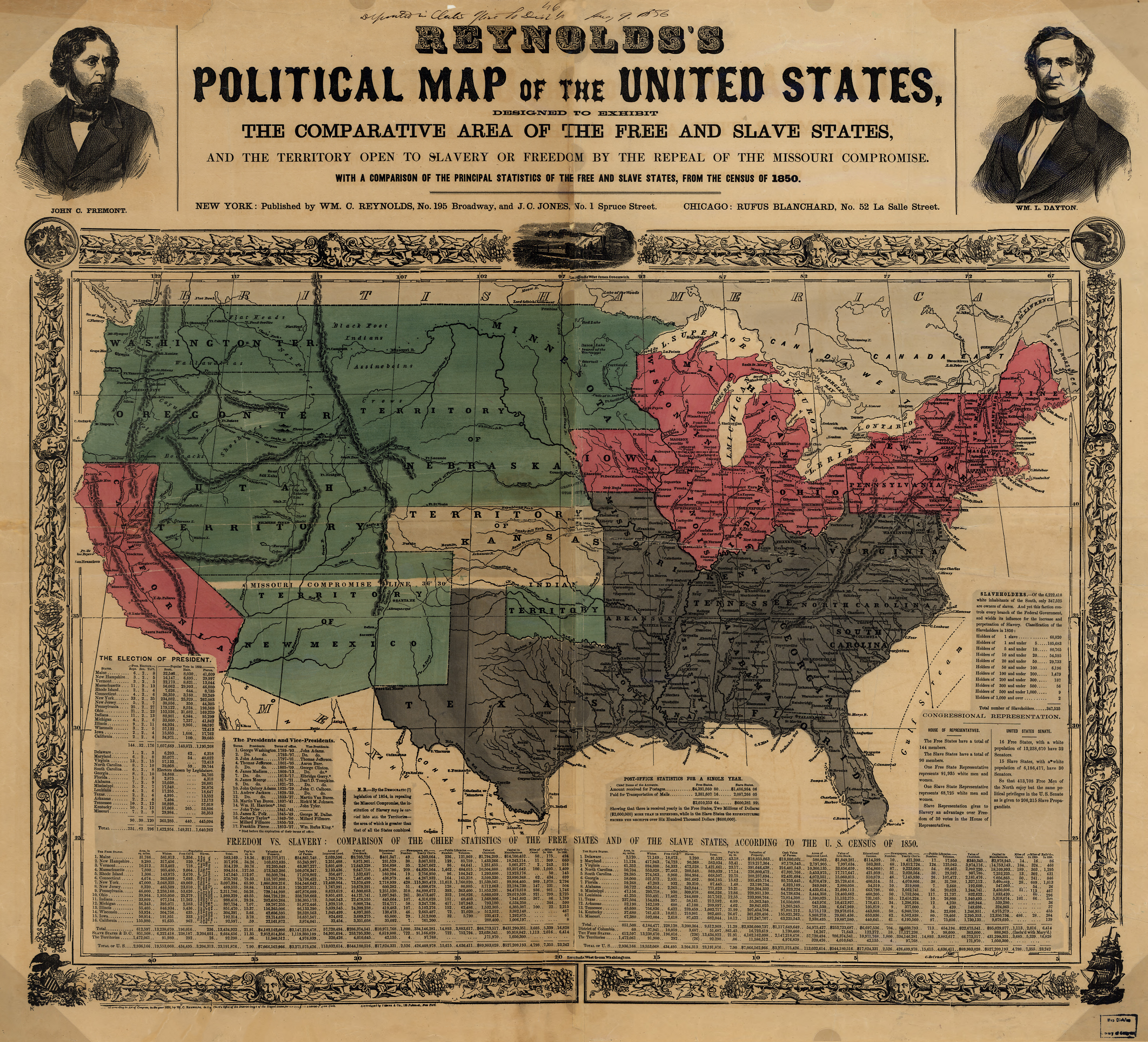
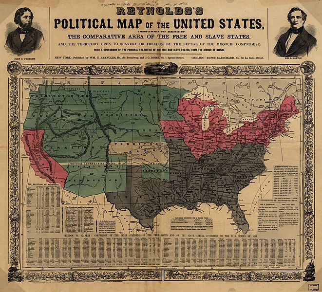
Archivo: Reynolds's Political Map of the United States 1856
Tamaño de esta previsualización: 661 × 600 píxeles. Otras resoluciones: 265 × 240 píxeles | 7813 × 7090 píxeles.
Archivo original (7813 × 7090 píxeles; tamaño de archivo: 35,27 MB; tipo MIME: image/jpeg)
Description: US map 1856 shows free and slave states and populations; this is "Reynolds's Political Map of the United States" (1856) from Library of Congress collection[1]
Title: Reynolds's Political Map of the United States 1856
Credit: "Reynolds's Political Map of the United States" (1856) from the Library of Congress Geography and Map Division
Author: Reynolds
Permission: This image is in the public domain due to its age.
Usage Terms: Public domain
License: Public domain
Attribution Required?: No
Usos del archivo
Las siguientes páginas enlazan a este archivo:

Todo el contenido de los artículos de la Enciclopedia Kiddle (incluidas las imágenes) se puede utilizar libremente para fines personales y educativos bajo la licencia Atribución-CompartirIgual a menos que se indique lo contrario.