
Archivo: ROC vs PRC

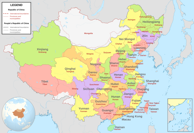
Descripción: Comparison between Republic of China and People's Republic of China administrative divisions. Grey lines are political boundaries drawn by the PRC. The formal names of these political entities are in black text. Red lines are political boundaries drawn by the ROC. The formal names of these political entities are in red text. Areas between red and grey lines (international boundaries) represent the territories claimed by the ROC but not the PRC.Adapted from File:ROC PRC comparison eng.jpg. The original ROC map included more cities, but the adaptation removed non-central municipalities to clean up the image. Therefore, this image contains: Republic of China 36 provinces 14 municipalities 2 areas 1 special administrative regionPeople's Republic of China 23 provinces 4 municipalities 5 autonomous regions 2 special administrative regions 1 territorial base
Título: ROC vs PRC
Créditos: Trabajo propio, basado en: China (+claims, +Hainan), administrative divisions - Blank - colored.svg Map of the Republic of China File:ROC PRC comparison eng.jpg
Autor(a): Milenioscuro
Términos de Uso: Creative Commons Attribution-Share Alike 4.0
Licencia: CC BY-SA 4.0
Enlace de Licencia: https://creativecommons.org/licenses/by-sa/4.0
¿Se exige la atribución?: Sí
Usos del archivo
Las siguientes páginas enlazan a este archivo:
