
Archivo: Pyrenees Mountains view from satellite
Tamaño de esta previsualización: 780 × 600 píxeles. Otras resoluciones: 312 × 240 píxeles | 2600 × 2000 píxeles.
Archivo original (2600 × 2000 píxeles; tamaño de archivo: 877 KB; tipo MIME: image/jpeg)
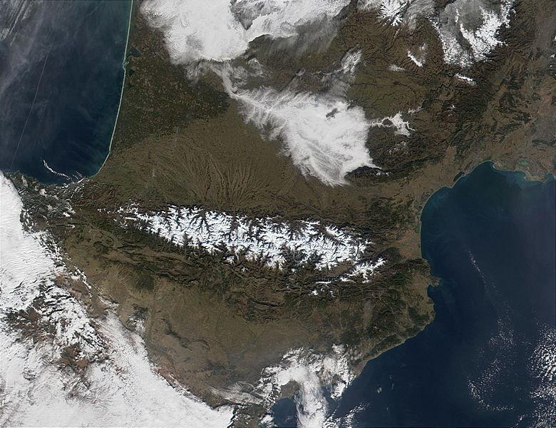
Descripción: The Pyrenees Mountains (center) act as a natural border between France to the north and Spain to the south. In this MODIS image from January 18, 2002, they are covered in snow (bright red in the false-color image.) At upper left, contrails are visible over the Bay of Biscay, which, along the French shores, sport miles and miles of white sandy beaches.
Título: Pyrenees Mountains view from satellite
Créditos: http://visibleearth.nasa.gov/view_rec.php?id=2690
Autor(a): Jacques Descloitres, MODIS Land Rapid Response Team, NASA/GSFC
Términos de Uso: Dominio Público
Licencia: Dominio Público
¿Se exige la atribución?: No
Usos del archivo
Las siguientes páginas enlazan a este archivo:

Todo el contenido de los artículos de la Enciclopedia Kiddle (incluidas las imágenes) se puede utilizar libremente para fines personales y educativos bajo la licencia Atribución-CompartirIgual a menos que se indique lo contrario.