
Archivo: Pyrenees-Atlantiques-fr-cropped
Tamaño de esta previsualización: 800 × 360 píxeles. Otras resoluciones: 320 × 144 píxeles | 1738 × 782 píxeles.
Archivo original (1738 × 782 píxeles; tamaño de archivo: 726 KB; tipo MIME: image/png)
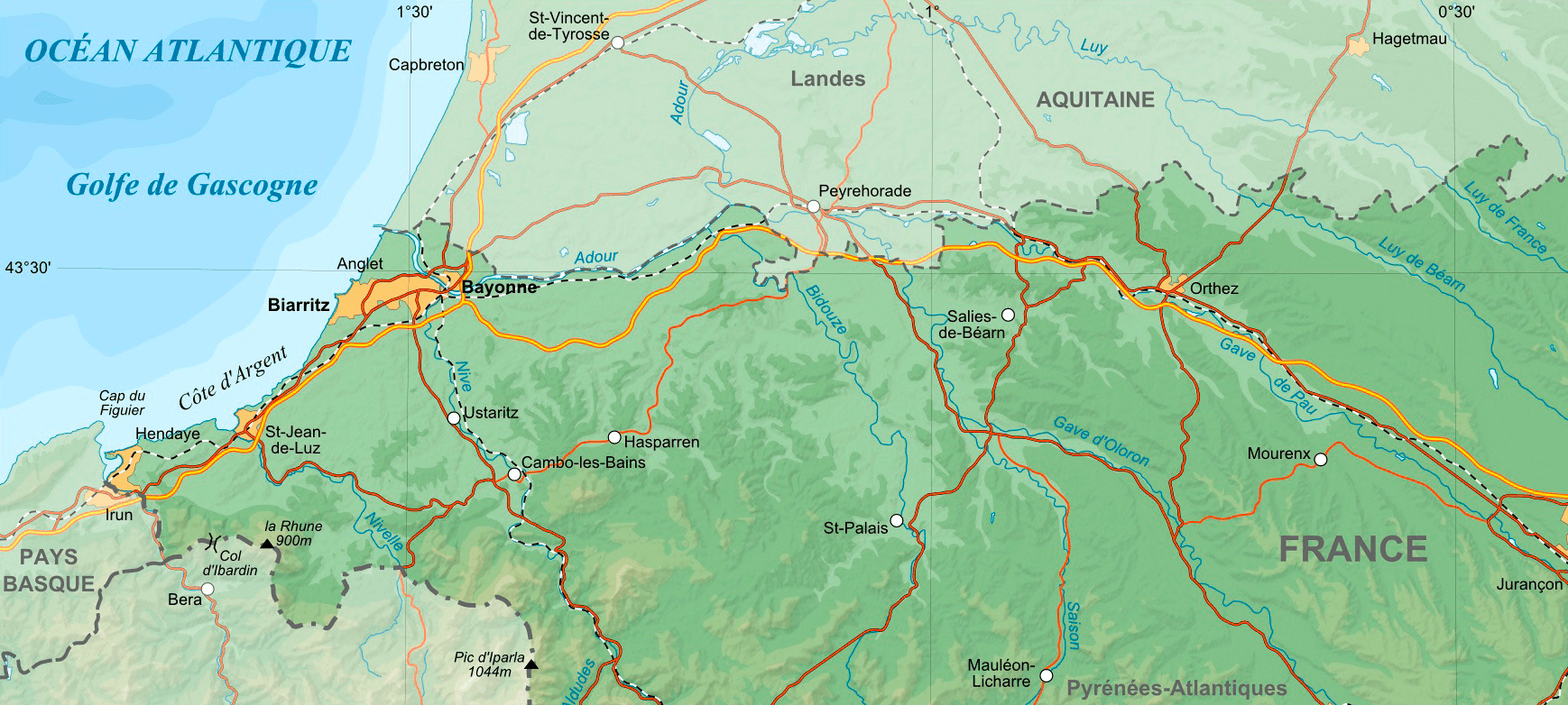
Descripción: Map of French department of Pyrenees-Atlantiques cropped to show only the area between Bayonne and Orthez.
Título: Pyrenees-Atlantiques-fr-cropped
Créditos: Wikipedia Commons map File:Pyrenees-Atlantiques topographic map-fr.jpg. Cropped to a smaller area to show the 1814 military campaign of Bayonne and Orthez.
Autor(a): Eric Gaba (fr:User:sting)
Términos de Uso: Creative Commons Attribution-Share Alike 4.0
Licencia: CC BY-SA 4.0
Enlace de Licencia: https://creativecommons.org/licenses/by-sa/4.0
¿Se exige la atribución?: Sí
Usos del archivo
La siguiente página enlaza a este archivo:

Todo el contenido de los artículos de la Enciclopedia Kiddle (incluidas las imágenes) se puede utilizar libremente para fines personales y educativos bajo la licencia Atribución-CompartirIgual a menos que se indique lo contrario.