
Archivo: Puerto de Veracruz Desastre Huracan Karl 2010
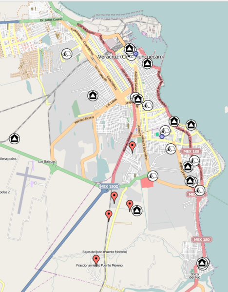
Descripción: Map of the Veracruz City (Puerto de Veracruz) due to the Hurricane Karl Disaster in September 2010. Drastical floods took place with several parts of the City and other Regions several damaged. Hundreds of people were affected. Mark descriptions: Red mark, Incidents reported; Black houses, Warehouses; Camping tents, Shelters; Blue dots, multiple. The information in the map is not completed. Many particulars and organization as well as the government of the State of Veracruz make efforts and support facilities, nevertheless anyone is to be known to have a complete report of such information. The information was taken from the local media, mainly internet web pages of local newspapers and radio station "XEU de Veracruz". The information is detailed in the referenced website (source).
Título: Puerto de Veracruz Desastre Huracan Karl 2010
Créditos: Veracruz Disaster Site from Sahanafoundation
Autor(a): Gengiskanhg
Términos de Uso: Creative Commons Attribution 3.0
Licencia: CC BY 3.0
Enlace de Licencia: https://creativecommons.org/licenses/by/3.0
¿Se exige la atribución?: Sí
Usos del archivo
La siguiente página enlaza a este archivo:
