
Archivo: Prusse1751Vaugondy aires
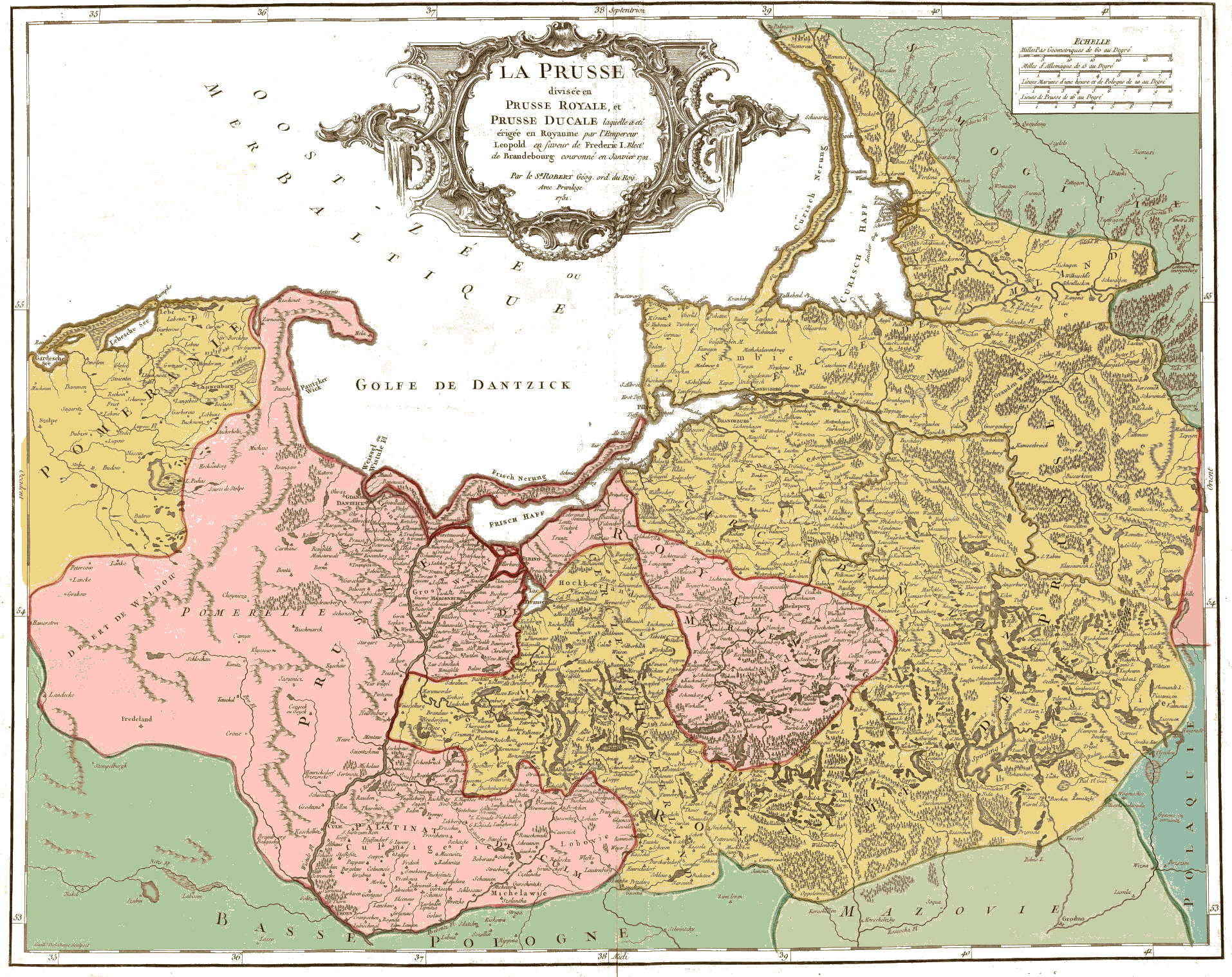
Descripción: Map of Prussia in 1751, with Royal Prussia (Polish) shown in pink and the Kingdom of Prussia (Brandenburg), formerly Ducal Prussia shown in dark gold. French map caption: “La Prusse, divisée en Prusse Royale, et Prusse Ducale laquelle a été erigée en Royaume par l'Empereur Leopold en favour de Frederic I. Elect. de Brandebourg couroné en Janvier 1701. Par le Sr. Robert Geog. ord. du Roy. Avec Privilege. 1751. Guill. Delahaye, sculpsit.”
Título: Prusse1751Vaugondy aires
Créditos: Adaption: Removal of the brown background colours of the old paper, copy of original boundary colours to the whloe areas, surrounded by them. The darker colours were used in pale versions, found at the edges of the original boundary colouring.
Autor(a): Gilles Robert de Vaugondy
Términos de Uso: Dominio Público
Licencia: Dominio Público
¿Se exige la atribución?: No
Usos del archivo
La siguiente página enlaza a este archivo:
